Abbot John Whethamstede’s Chronicle of the Abbey of St Albans
Abbot John Whethamstede's Register aka Chronicle of his second term at the Abbey of St Albans, 1451-1461, is a remarkable text that describes his first-hand experience of the beginning of the Wars of the Roses including the First and Second Battles of St Albans, 1455 and 1461, respectively, their cause, and their consequences, not least on the Abbey itself. His text also includes Loveday, Blore Heath, Northampton, the Act of Accord, Wakefield, and Towton, and ends with the Coronation of King Edward IV. In addition to the events of the Wars of the Roses, Abbot John, or his scribes who wrote the Chronicle, include details in the life of the Abbey such as charters, letters, land exchanges, visits by legates, and disputes, which provide a rich insight into the day-to-day life of the Abbey, and the challenges faced by its Abbot.
Available at Amazon in eBook and Paperback format.
Archaeologia Cambrensis 1872 Pages 81-143 is in Archaeologia Cambrensis 1872.
Notes of some South Wales Cromlechs by E L Barnwell.
In a previous notice of some cromlechs in North Wales, given in the Archaeologia Cambrensis of 1869, an opinion was expressed that at that period of time the question of the nature and original use of cromlechs might be considered finally and satisfactorily settled. It was, indeed, admitted that it was not impossible that there might still survive some disciples of the Druid-altar school, who had not yet been able to understand the arguments, or were unwilling to admit the conclusions, of those who are generally considered to have made out their case, namely, that this class of megalithic remains, whatever the variety of dimensions, form, structure, or other accidents, is simply to be referred to the sepulchral usage of some very early race or races. The possibility thus anticipated turns out to be actual fact; for not only do such individuals still exist, but some have 'undertaken to prove that what up to this time has been generally received as the satisfactory solution of a question so extensively and effectually ventilated, is simply an egregious blunder, that the premisses and deductions of those who hold a contrary opinion are inadmissible, and that it is high time that such erroneous teaching should be fn by sounder and more unquestionable doctrine,
To show that this statement is not made without good grounds, it will be sufficient to allude to a book which made its appearance last year under the title of Druidism Exhumed the principal object of it being to prove that Mr. John Stuart of Edinburgh knows nothing about stone circles and cromlechs.
Now up to last year the exhaustive examination of this question, especially as regards the circle (as set forth by that gentleman in his magnificent volumes of the Sculptured Stones of Scotland, and more particularly in the second volume), had been considered as near an approximation to actual proof as the subject admitted. If the logic of facts is worth anything, if accumulated evidence is to be received as it deserves, and if deductions, the accuracy of which is not denied, are admitted, the circle-question might be considered as disposed of, at least for the present, or at any rate until future discoveries may throw new light on the matter. But this, unfortunately, is not to be. The author of Druidism Exhumed has, at least to his own satisfaction, proved that his friend and compatriot is altogether wrong in his views, as these circles are really Druidic temples, or courts of justice or of assemblies, or of sorcery and magic, or consecrated to the rites of fire-worship or even of Moloch. Such a discovery would be one of great interest, if it could be proved to have any other existence than in the imagination of the discoverer. How far such is the case in the present instance will be best ascertained from the discoverer himself. Thus may be read, commencing at p. 268:
"Worship of Molech.—The parish of Methlic or Medlech, or Medleck, in Aberdeenshire, is a parish full of Druidical remains, including a number of cairns. These had been sepulchral; and the name itself of the parish testifies to its origin. It is called Medlech or Medleck. There is another word, Molech, Molech and Medlech, or Medleck, meaning the same. They are derived from mò and moid, the first and second comparatives, having the force and meaning of superlatives of the adjective mòr, 'great,' and leac, or leachd, or leacht (gen. lice, fem.), 'a tombstone'. Mhò-leac, Molech, and Mhoid-leac.
The dolmens to be described are, with by the exception of one (namely that of Dolwilym), in Pembrokeshire; and even this exception is so near the boundary of that county, that it may be consdidered as belonging to the county of Pembroke.It is observable that they, asa general rule, are to be found in this district where trap rocks exist.

The first to be described is one [Hanging Stone aka Burton Burial Chamber [Map]] in the parish of Burton, near Haverfordwest, and on the estate of J. H. Scourfield, Esq., M.P. It was inspected when the Society, in 1864, visited the county under the presidency of that gentleman; at which time it was built round with loose stones, and used as a small sheepcot. It has since been cleared out, and is now seen to much better advantage than when visited by the Society. At that time there were some small remains of the original packing of small stones in the interstices between the slabs,—a very unusual occurrence. What was left was but a very small portion, but quite sufficient to give an idea of the firm manner in which this dry rubble-work was worked in. It is too far off to have any direct relation with the singular alignment (described by Sir Gardner Wilkinson in the Archæologia Cambrensis of 1870, p. 120) near Benton Castle, which has, however, at least one ruined dolmen connected with it. The capstone, from north to south, is 10 feet 2 inches by 81 feet, with a thickness of 4 ft. 3 ins.; and from the highest point of the exterior, from the ground, is 9½ ft. The upright stone on the south side is 6 ft. 1 inch; that on the east side is 5 ft. 3 ins.; and that on the north side, 5 ft. 5 ins. Cut No. 2 represents the south side, and is from a drawing by Mr. James Tombs.

Cut No. 3 gives the west side, from a sketch by his sister, Miss Grace Tombs. It is known as the hanging stone; an unusual name in Wales for such remains, if this part of Pembrokeshire can be called Welsh. Some have questioned the usual derivation of the word Stonehenge; but here, at least, seems to be one confirmation of it.
The more remarkable point, however, is that the chamber runs nearly north and south, the contrary to the more usual direction of east and west, the The Society is indebted to the Rev. J. Tombs, one of the local secretaries for the county, for these measurements and other details,
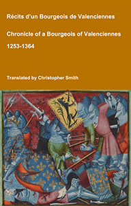
Chronicle of a Bourgeois of Valenciennes
Récits d’un bourgeois de Valenciennes aka The Chronicle of a Bourgeois of Valenciennes is a vivid 14th-century vernacular chronicle written by an anonymous urban chronicler from Valenciennes in the County of Hainaut. It survives in a manuscript that describes local and regional history from about 1253 to 1366, blending chronology, narrative episodes, and eyewitness-style accounts of political, military, and social events in medieval France, Flanders, and the Low Countries. The work begins with a chronological framework of events affecting Valenciennes and its region under rulers such as King Philip VI of France and the shifting allegiances of local nobility. It includes accounts of conflicts, sieges, diplomatic manoeuvres, and the impact of broader struggles like the Hundred Years’ War on urban life in Hainaut. Written from the perspective of a burgher (bourgeois) rather than a monastery or royal court, the chronicle offers a rare lay viewpoint on high politics and warfare, reflecting how merchants, townspeople, and civic institutions experienced the turbulence of the 13th and 14th centuries. Its narrative style combines straightforward reporting of events with moral and civic observations, making it a valuable source for readers interested in medieval urban society, regional politics, and the lived experience of war and governance in pre-modern Europe.
Available at Amazon in eBook and Paperback format.
No. 2. The Manorbeer cromlech [King's Quoit, Manorbier [Map]] has been already described in the Third Series of the Arch. Camb., and by Sir Gardner Wilkinson in one of the Collectanea volumes of the British Archaeological Association. There are certain anomalous features about it which seem to render it a rather exceptional example. The capstone, 16 feet 9 inches long by 8 feet 6 inches broad, has one of its ends resting on a small block of stone, and the other on three low supporters nearly at right angles to each other. Immediately above the block of stone is a wall of limestone, which Sir Gardner thinks has furnished the capstone, the thickness of which is 1 ft. 9 ins. It lies to the north-east, and the entrance is at the north-eastern extremity. Sir Gardner Wilkinson thinks this may have been an exceptional case as regards its not having been enclosed in a mound or cairn, as the ground on both sides falls away too sharp to admit of one. Although in the present state of the spot on which it now stands, it would have been almost impossible to build any mound over it, yet who can say what changes may not have taken place since its erection, and that at one time this difficulty did not exist? At any rate it must have had some external protection if it were a grave, unless, as suggested by Sir Gardner, it is the cenotaph and monument of some chief who perished in the waters below. Still, however, it may be questioned whether an uncovered and imperfect structure as this could ever have been thought an appropriate honour worthy of a great chief; for the cenotaph, in any case, would be after the usual form and fashion of a tomb of that period, which these bare stones certainly did not represent.
3. Pentre Ifan [Map] or Evan cromlech stands on the north-eastern slope of the Carn Ingli ridge, on the crest of which are numerous remains of circles and other traces of human occupation, although now a wild heath, far removed from dwellings of any kind. Lower down, however, enclosures have of late years been made; so that although the ground on which this relic stands is open and uncultivated, yet immediately behind it are a high bank and hedge, which do not appear in the cut here reproduced from the volume of 1865. This dolmen is the highest in Wales; and, when perfect, was probably the largest also, if any inference may be drawn from existing remains. In the Additions to Gough's Camden (1789, vol. ii, p. 521) will be found a description of it as it was in the time of George Owen, the historian of Pembrokeshire, who lived nearly three centuries ago. Fenton has also (p. 560) given an extract from the same writer, accompanied with an engraving of it as it was in his own time, some seventy or eighty years ago, and which does much more justice to the imposing character of the structure than the small though accurate one here given. After mentioning its huge proportions, he goes on,—"There are seven stones that do stand circle-wise, like in form to the new moon, under the south end of the great stone, and on either side two upright stones confronting each other. Doubtless it was mounted long tyme sithens, in memorie of some great victory, or the burial of some notable person, which was the ancient rite; for it is mounted on high, to be seen affar off, and divers tall stones round it, set in manner much like to that which is written in the first book of Maccabees (cap. xiii), onlie that this our trophy is of ruder forme. They call the stone1 Gromlech; but I think the true etymologie is Grymlech, that is, the stone of strength, for that great strength was used in the setting it to lye ~~ msorte as it doth."
Note 1. This is probably one of the earliest instances of the name of cromlech being applied to such ruined chambers, although it occurs twice in the Welsh Bible of 1588 (see Isaiah, ch. v and lvii), followed by creiginu, "the holes and clefts of the rocks" of the English version.


From the Additions to Camden we learn that a circle of rude stones, 50 ft. in diameter, surrounded "the large stone 18 ft. long, 9 broad, and 3 thick at one end, supported by three large rude stones about 8 ft. high, with five others which do not contribute to its support. The area under this stone is neatly flagged. A piece about 10 ft. long and 5 broad, more than twenty oxen could draw, broken off the larger stone, lay by it."
Sir Gardner Wilkinson has also given an account of this monument in the volume already alluded to. His measurements vary but little from those above stated, except that he gives the length and breadth of the capstone 16½ ft. and 9 ft. 4 ins., and about 2½ ft. at the southern and thickest end. He states also that the capstone 1s supported by two only of the upright stones, the third being two inches shorter than its companions, "The two highest are 7 ft. 9 ins., and the northern supporter is 7 ft. high." These measurements may be relied on as the correct ones. The dimensions given in Camden have evidently been taken roughly. "Adjoining it, at the south-eastern corner, are two large upright slabs quite unconnected with the support of this monument; and three fallen stones lie towards the north end, partly beneath the capstone, and another a short way from it, to the south-west." Sir Gardner thus accounts for nine stones independently of the capstone; but there are several others close to it, although excluded from sight by the high bank behind the chamber. These have af formed parts of the original structure, and have been removed out of the way, under and along the banks and hedges of the enclosed field. Some of these are about 8 or 9 ft.long. The late Rev. H. Longueville Jones thought that originally there was more than one chamber, which is not unlikely; but at any rate it is quite certain, from the present remains, both standing in their original positions and scattered about, that we have in the Pentre Evan monument the remains of a very large chamber or chambers. The flagged area (now, indeed, stripped of its flagstones) is sufficient proof of itself that there was a chamber, in spite of Mr. Fergusson's bold statement that there never could have been one. The slabs which Sir Gardner speaks of as quite unconnected with the support of this monument, must have been connected with something. It is evident these were placed in their position for some purpose, which was probably to support the capstone of a secondary chamber, unless we suppose cne long chamber covered by two or more capstones. George Owen speaks of 2 fragment of the present capstone, 10 ft. long. If he is correct, this would make the original length of the capstone nearly 30 ft.; but at present there are no traces in the existing one of any such fracture, so that it is not impossible he was mistaken, and that the stone he saw was the capstone ot that part of the structure where the slabs mentioned by Sir Gardner Wilkinson stand. It was a mistake easily made by George Owen, who never suspected the prolongation of the existing chamber towards the south, or the existence of a second chamber, as we find in the Plas Newydd [Map] monument. The size of this monument, and the bare, rocky nature of the ground, have induced some to think that it was never covered up, although they must be at a loss to explain what it could have been built for, and for what possible use, if it had not been protected in some way or other. There are, however, some scanty traces of the former envelope, unless they have been removed since Mr. Longueville Jones visited the spot. There is a curious pitched path leading through a wood from the lower ground, in the direction of this dolmen. Nothing is known of its history, and even local tradition is silent. All that can be said of it is that it was apparently made at a time when the population of the district was located more on the higher grounds than at present, and that this pitched way was for their especial accommodation. It may also have been the ordinary trackway of the district before other means of communication existed1.
Note 1. The late Rev. J. Jones, better known by his bardic name of "Tegid," and some time vicar of Nevern, stated in 1847, that in the field adjoining the land where the cromlech stands, about two hundred and fifty yards to the north-east, was a huge recumbent stone, "evidently" (to use his own words) "intended for an altar, but broken in the act of being lifted up or hoisted." At one end of the stone were two large artificial holes, for the insertion of poles used in lifting up the stone, or supporting it when lifted up. Close at hand there was a rock, or a rock-like stone, with large holes in it, made Apparently to rest the ends of the poles in them while the stone was being lifted up. (See Arch. Camb., 1847, p. 374.) Both Fenton and Sir Gardner Wilkinson appear not to have heard of such a curiosity.

Cut No. 6 represents the cromlech Llech y Dribedd [Map], which stands two miles and a half to the north-east of Nevern Church. It has been described by Sir Gardner Wilkinson in the notice already mentioned. The capstone 1s nearly 8 ft. long, and from 3 to 4 thick, having, according to Fenton, a circumference of nearly 40 ft, Its three supporters vary from 3 to 4 ft. 8 ins. A fourth stone lies beneath it, and had assisted in forming a side of the chamber; but had not, in all probability, ever supported the capstone.
The great massiveness of this latter, as compared with the dimensions of the supporters, is somewhat unusual, although it is exceeded in some other cases. There was apparently some object in view in preferring such unnecessarily large masses; but whatever it was, it was certainly not the intention of the builders to display their power and skill in dealing with such masses to future generations of men, as we have seen asserted.
Nearer Nevern is the cromlech of Trellyffant or Trellyffan [Map], near Tredrysi. The capstone measures 6 ft. 10in. by 6 ft., and has an average thickness of 2 ft. 4 ins. It has been forced from its original position on the supporters, and turned sideways. Sir Gardner Wilkinson alludes to a small stone inserted between the south: south-west corner of the covering slab, and a supporter which is probably the last relic of the original dry rubble-work, and not intended to act as a wedge assisting in the support of the capstone. Sir Gardner conjectures that the raised ground on which this monument stands may be the remains of a former mound.

One ot the most perfect and interesting dolmens [Gwal y Filiast Burial Chamber [Map]] in Wales stands in the grounds of Dolwilym, in the northern extremity of the parish of Llanboidy, in Carmarthen-shire. The spot in which it is placed commands a singularly picturesque view of the vale and river of Taf, and is about midway down the steep slope on the right side of the river. Originally the chamber consisted of five or rather six stones, although only four now remain. The fifth, now missing, filled up the empty space at the south-west angle; and in all probability there was a second small stone at the eastern end, as the one now there could not, from its shortness, have closed that entrance. The western side is formed of one large stone on which the capstone rests; whence it is certain that the entrance was not here, but at the opposite end, towards which also the capstone gradually inclines. The upright stone at the eastern end is only about 2 ft. high; that at the opposite extremity being 4 ft. 4 ins.,—a difference that would not be expected from the almost horizontal position of the capstone. Sir Gardner Wilkinson gives the length and breadth, 11 ft. 6 ins. and 8 ft. 10 ins. Another measurement, taken diagonally, gave the two diagonals, 11 and 10 ft. There are several scattered stones lying about, all probablyconnected with the chamber and mound; of which last, however, hardly any traces remain. There are in all thirty-two stones within the circle; but the exact position, on account of the long and wet grass, was not ascertained with any accuracy of detail on the occasion of its being examined; but at any rate there are the remains of the circle of Isolated stones which constantly surrounded the base of the tumulus, at, some little distance from it. It has two names according to E. Davies, the author of the well known volumes on Celtic antiquities and Druids, one of Which is Burdd Arthur (Arthur's table), and the other, Gwâl y Vilast (the couch of the greyhound bitch). Of this animal there are many records scattered over Wales, Thus Ffynnon Milgi, in Llanelidan parish, in Denbighshire, is one instance. The inner sides of the upright stones are smooth and regular, while the lower face of the capstone, contrary to the more usual practice, is extremely rough and rugged. Near it is what is known as Crochan Arthur.
In a field called "Parc y Bigwrn," and in Pensarn farm, in the same parish, are the remains of a cromlech [Parc y Bigwrn Burial Chamber [Map]] destroyed about sixty years ago. Two of the supporting stones are still erect, and near them lie the remains of the rest of the chamber. One of them, nearest the hedge, is 8½ ft. by 4½ ft., the average thickness being 3 ft. Another was broken, about sixty years ago, into two parts, and one of them removed on a sledge drawn by six horses. All that now remain are six in number, including the part of the broken stone not removed. They vary in dimensions from 7 or 8 ft. to 4 ft. in length. Their average breadth is about 3½ ft.. Our informant (John Jones), a man of more than eighty years of age, has always lived close to the spot. His memory and his character for veracity are equally good, and he remembers the capstone having been shifted from the west bearer; but had been told by his seniors that it had previously been horizontal, and was known as the table. It was subsequently thrown on to the ground, where it now remains. It may be as well to give the old man's exact words: "Yr oedd chwech ceffyl yn tynu y gareg, ac yr oedd y car llusg yn rhwygo vy ffordd. Yr oedd yno tua 10 o ddynion wrth y gorchwyl, ac yr oeddent yn llawn braw pan yn cyffwrdd â'r gareg." The English of which is: "There were six horses drawing the stone, and the road was rent asunder. About ten men were engaged, and they were full of awe when touching the stone."
This superstitious dread of disturbing stones of this kind was once almost universal in the Principality as well as in Brittany, and is still felt by many of the country people. The phenomena are various. Sometimes it is violent thunder and lightening, or fierce torms of hail and wind, a swarm of bees, or mysterious noises. One common warning is the breaking down of the waggon, or some similar misfortune; and if an accident of the kind does happen, their faith in these superstitions is considerably augmented. Many years ago the late Lord Bagot removed the Emlyn Stone from Bedd Emlyn to his residence at Pool Park near Ruthin, the distance being hardly two miles, and the stone not of very large size. The transport, however, took two days, and the waggon did break down for some reason or other; so that the whole transaction was looked on as very mysterious, and confirmatory of the local superstition. So in this instance the road is said to have been rent, and it may be supposed in so very unusual a manner as to be thought supernatural; while the labourers employed felt some mysterious awe, of which they could give no account.
William of Worcester's Chronicle of England
William of Worcester, born around 1415, and died around 1482 was secretary to John Fastolf, the renowned soldier of the Hundred Years War, during which time he collected documents, letters, and wrote a record of events. Following their return to England in 1440 William was witness to major events. Twice in his chronicle he uses the first person: 1. when writing about the murder of Thomas, 7th Baron Scales, in 1460, he writes '… and I saw him lying naked in the cemetery near the porch of the church of St. Mary Overie in Southwark …' and 2. describing King Edward IV's entry into London in 1461 he writes '… proclaimed that all the people themselves were to recognize and acknowledge Edward as king. I was present and heard this, and immediately went down with them into the city'. William’s Chronicle is rich in detail. It is the source of much information about the Wars of the Roses, including the term 'Diabolical Marriage' to describe the marriage of Queen Elizabeth Woodville’s brother John’s marriage to Katherine, Dowager Duchess of Norfolk, he aged twenty, she sixty-five or more, and the story about a paper crown being placed in mockery on the severed head of Richard, 3rd Duke of York.
Available at Amazon in eBook and Paperback format.
About two or three hundred yards from these stones, on the left hand, there is a small mound, about 50 ft. in diameter, which the then occupier attempted to remove, but a most terrible thunderstorm put an end to his proceedings, and the mound has remained there ever since, as he left it. This occurred about fifty years ago, and its truth is certified to by the wife of the old man John Jones. We are indebted to Mr. Benjamin Williams, of Llangan School, for these details.
Cut No. 7 represents the south or nearly south side of the Dolwilym chamber [Gwal y Filiast Burial Chamber [Map]]. The gap at the south-west corner was originally filled up by a slab, as already observed.
Cut No. 8 gives the north side, which consisted of a single slab joining the western one at right angles. The stone at the east end does not appear in the cut to be so much lower than the large western slab. A third and different view will also be found in one of the Plates.


Overlooking the little church of Llanwnda, near Fishguard, is what some, perhaps, would call a variety of the demi-dolmen [Garnwnda Burial Chamber [Map]]; but which is an ordinary dolmen, the capstone of which has slipped, and now rests in a standing position on only one of its supporters. It measures 14 ft. according to Fenton, and is somewhat of triangular form; not very dissimilar to the "Coetan Arthur [Map]" ~ cromlech near Criccieth (described in the Arch. Camb. of 1869, p. 135) in outline of form, but in its thickness very different from the rude masses such as those of Llech Tribedd and others. It is only 20 inches thick. The supporting stones are also of the same character. This dolmen is in such a dilapidated state that it does not contribute any light to the general subject, except as shewing how much the character of such structures depends on the kind of stone available. But for this fact one might be tempted, from its less massive character, to look upon it as somewhat later than the more massive and rougher monuments. On the lower ground are several upright stones irregularly placed; but it would be dangerous to speculate upon their character, as, with the exception of three or four, their age is very questionable.

Proceeding onwards, towards Strumble Head, the cromlech-hunter will find one [Garn Gilfach Burial Chamber [Map]] at a place called in the Ordnance Map Gilfuch Goch, a view of which will be found in the Plates. It is of unusual character in having its capstone supported on a row of low stones,—so low that none but a very slender man, lying flat on the ground, could insinuate himself underneath. The capstone is nearly 14 ft. long, 8 wide, and 2 ft. thick, while all around are lying the relics of the former carn or tumulus. Mr. Blight did succeed in getting under the stone, but found only a fragment, of flint, which must have been placed there, as there is no natural flint in the country. It is also difficult to imagine how this grave could have been available for secondary interments, as the usual means of access to the interior do not exist. The following is Fenton's account, whose measurements do not exactly agree with those given above: "There is one more remarkable than the rest,—a large, unshapen mass of serpentine, 15 ft. by 8, and 2½ thick. Under the edges of it are placed nine or ten small, pointed, upright stones embedded in a strong pavement extending for some way round. These small supporters are seemingly fixed without any regard to their height, as only two or three bear the whole weight of the incumbent stone, one of which is so pressed by it as to have become almost incorporated with it. On the upper surface of the cromlech are three considerable excavations, near the centre; probably intended to have received the blood of the victim, or water for purification, if (as is the most general opinion) they were used as altars. Its height from the ground is very inconsiderable, being scarce one foot high on the lowest side; and on the other only high enough to admit of a person creeping under it, though when once entered the space enlarges from the upper stone, having a considerable concavity. The earth below is rich and black" (which he afterwards ascertained was chiefly the result of fire, as many bits of charcoal and rude pottery have been picked up there). A farmer informed Mr. Fenton that two or three years before his visit two spear-heads were found, laid across each other, and a knob of metal, suspected to have been gold.
Another cromlech is given in the map as at Pont Iago, but it could not be found on the occasion of this visit. It may still be there, concealed among the heath, if it is of the same low character as that at Gilfach; or it may have vanished altogether, in the usual manner. It could not, however, be found on the occasion alluded to, after a diligent search; nor does Fenton seem to have known of it,—at least he does not mention it.
Within a short distance is a place called "Ffynnon Druidion [Map]," and another "Llan Druidion [Map]," whence Fenton draws the conclusion that these names, as well as the numerous megalithic monuments there, prove that this was a favourite residence of the Druids. But has the word "Druidion" anything to do with Druids? The Welsh for a Druid is "Derwydd." "Ceryg y Druidion," in Merioneth, popularly translated stones of the Druids, is said by Welsh scholars to be rather stones of brave or strong men. "Druidion" seems to be the English word Druid with a Welsh plural suffix; and it is difficult to conceive how such a barbarous word can be of such antiquity as might be assigned to names of places in Wales. The assigning of it in these two instances, where megaliths abound, only shews that these stones were thought, in later times, to be Druidical by those who gave the names. But then remains the difficulty, how such a hybrid word as "Druidion" could have come into existence in a district where English is hardly to this day understood. "Drudion" means "heroes" or "brave men."
Near Ffynnon Druidion was once a small dolmen, now so entirely demolished that only one or two of its stones are left to mark where it stood; but it was here that five flint celts were discovered, and which had, no doubt, been buried with the corpse.
A little lower, to the westward, was in Fenton's time a circle of stones, in the centre of which was discovered a stone hammer. One of the flint celts and hammer are figured by Fenton. He does not state the kind of stone of which the hammer is made. The flint weapons are well worked, and must have been brought from a great distance.

In the adjoining parish of St. Nicholas is a dolmen [Ffyst Samson Burial Chamber [Map]] which might pass for one of the free-standing or tripod ones, as all that is left of the original chamber are two supporters and the capstone, the latter resting on two separate points of one of the supporters. It is 7 ft. 9 ins. long by 6 ft. 7. ins.: measurements which do not agree with those given by Sir Gardner, who gives the breadth only 3 ft. 10 ins., and which is probably an error of the printer. The highest of the two supporters is 5 ft. 8 ins., being 2 ft. more than the other. The thickness of the capstone is a little under 2 ft. The chamber must have been small. Slight remains of the cairn still lie around. The situation is very conspicuous. At a short distance, In the lower ground, stand some pillar-stones; portions, in all probability, of a stone circle.
In Mathri (martyrs) parish are the remains of a large chamber [Mathri Burlal Chamber [Map]], consisting of a capstone 13 ft. long by 8 broad, resting on one low supporter, the whole partially buried in the hedge. This apparently is the one mentioned by Fenton, who gives the length 14 ft.; and states that it was supported by stones 4 ft. high on one side, and scarcely 3 on the other. He speaks also of a cistvaen at one end, which had lost one side and its cover. This may have been a small secondary chamber. Another cromlech, according to the Ordnance Map, ought to be near it; but no traces of it are now remaining, and it is to be recretted that Fenton does not even allude to it.

The Longhouse cromlech [Carreg Sampson aka Longhouse Burial Chamber [Map]] is the finest of those in this part of the country, and, perhaps, one of the finest in all Wales. It is somewhat masked by the hedge and bank against which it stands, and which have not been introduced in the drawing. In Fenton's time the capstone rested on four of the uprights: at present it rests on three. The six uprights, however, mentioned by him still remain. He also states the length of the capstone to be from 16 to 18 ft.; but its maximum length, according to Sir Gardner Wilkinson, is 15 ft. It 1s nearly 9 ft. across in the broadest part; the highest supporter being 5 ft. 8 ins. long, and the lowest 4 ft. 7ins. It stands in an elevated position, within sight of the sea. All traces of its former covering have disappeared, as the land on which it stands has been for a long time cultivated.
If the cromlech [Carreg Coetan Arthur Burial Chamber [Map]] close to the town of Newport does not present so imposing an appearance, from its magnitude, it is not inferior in interest, from its well preserved condition. The chamber measures 5 ft. 6 ins, by 4 ft. 6 ins. The capstone is 10 ft. by nearly 9, and is from 3 to 3½ ft. thick. It stands only on two of the four upright stones. Remains of a tumulus or carn still exist. It is called "Careg Coetan," and is associated with the name of Arthur.
On the right hand of the road going from Newport to St. David's is a curious group of five small chambers radiating from a common centre, a perspective view and plan of which are given in the accompanying Plates. The chambers are tolerably perfect; but of the five capstones only three remain. The central unoccupied space is longer than broader, the greatest diameter being 19 ft. 1 inch. The capstones vary from 11 to 9 ft. long, and the average dimensions of the chambers from 5 to 6 square feet. The measurements of the stones forming the most perfect of the chambers (a), commencing from the stone lying out of its place, and keeping to the right hand, are 3 ft. 2 ins., 3 ft. 5 ins., 4 ft. 8 ins., 5 ft. 3 ins., 5 ft. 10 ins., 2 ft. 4 ins., and 3 ft. 6 ins. It is doubtful, however, whether the first stone (3 ft. 2 ins. long) does belong to this chamber at all. The capstone of cis 11 ft. 9ins. long, and 1 ft. 9 ins. thick. The average height of the upright sides is 3 ft. 6 ins. According to Fenton the central space was occupied by a cromlech, which he describes "as long since overturned." He states also that there was a large circle of tall stones around it, forming what he terms "the mysterious precinct". He removed the capstones of the five chambers, and digging down about a foot, through fine mould, came to charcoal, then pieces of urns of the rudest pottery, some particles of bones, and a quantity of black sea-pebbles. In the central space where, he states, a cromlech had once stood, he found no traces of burial, and hence inferred that it was intended for a very different use. In short, he found a fine Druid's nest, which, at least, he should have replaced as nearly as possible as he found it, instead of leaving the stones on the ground, much in the same state as they are at present, except that some of them have been since removed. This example is unique in Wales, and may be the same in the rest of Great Britain and Ireland.


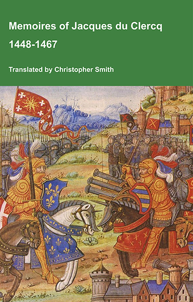
This is a translation of the 'Memoires of Jacques du Clercq', published in 1823 in two volumes, edited by Frederic, Baron de Reissenberg. In his introduction Reissenberg writes: 'Jacques du Clercq tells us that he was born in 1424, and that he was a licentiate in law and a counsellor to Philip the Good, Duke of Burgundy, in the castellany of Douai, Lille, and Orchies. It appears that he established his residence at Arras. In 1446, he married the daughter of Baldwin de la Lacherie, a gentleman who lived in Lille. We read in the fifth book of his Memoirs that his father, also named Jacques du Clercq, had married a lady of the Le Camelin family, from Compiègne. His ancestors, always attached to the counts of Flanders, had constantly served them, whether in their councils or in their armies.' The Memoires cover a period of nineteen years beginning in in 1448, ending in in 1467. It appears that the author had intended to extend the Memoirs beyond that date; no doubt illness or death prevented him from carrying out this plan. As Reissenberg writes the 'merit of this work lies in the simplicity of its narrative, in its tone of good faith, and in a certain air of frankness which naturally wins the reader’s confidence.' Du Clercq ranges from events of national and international importance, including events of the Wars of the Roses in England, to simple, everyday local events such as marriages, robberies, murders, trials and deaths, including that of his own father in Book 5; one of his last entries.
Available at Amazon in eBook and Paperback format.
Several difficulties are presented by this grouping of small chambers round a central one: one of which is the question whether all the interments took place at one time, and one common mound was then heaped up over the group; or whether the central chamber was the original nucleus of the whole, the sides of the mound being from time to time opened for the purpose of building one of the smaller ones, as the practice of secondary Interment near the edge of the mound was very common. But if this were the case, we should have expected that the arrangement of the chambers would have been the same as that near Port Erin in the Isle of Man, described in the Arch. Camb., 1866, p. 54; that is, forming a continuous circle running round the central space, the position of the chambers being nearly at right angles to the present one. It is very much to be regretted that Fenton did not give some details of the arrangements before he thus pulled them to pieces. The chamber at A, which is also the most perfect, seems to be an exception to this radiation, and to assume a direction similar to the small chambers in the Isle of Man. The well known chambered tumulus of Jersey, now transplanted to Park Place, near Henley-on-Thames, has a circle of seven small square cells or cists opening towards the central space, whereas these appear to have their entrance in the opposite direction. There is, however, a certain similarity between this Carreg y Gof, as it is called, and the Jersey example, which, though in itself one of some difficulty, yet was certainly intended for successive interments, a roofed passage of 17 ft. leading to the interior circular space into which the seven chambers open. There can be no doubt, however, that the usual mound with its circle of detached stones covered the whole group; but it is impossible to say whether the whole work was done at one time, or the chambers added from time to time.
On the old road from Fishguard to the North, is the remarkable line of stones called "Parc y Marw," described in the Arch. Camb., 1868, p. 177, which led direct to a cromlech of which, in 1866, only one or two fragments remained. This is another instance of Fenton's handiwork. He is said to have pulled it down in his explorations, leaving others to complete the work of destruction, which has been carried on so effectively that even the few fragments that remained in 1861 have probably long since been removed.
Newton Burrows [Devil's Quoit Burial Chamber [Map]] dolmen has been already given in the Arch. Camb.; but the representation here given is rather more faithful. The support at one end has given way, leaving the capstone in its reclining position. It is over 12 ft. long, and one of the upright stones measures 4 ft. 2 ins. Fenton describes it as having a slight trench round it, as is so frequently the case with the tumuli on the Wiltshire downs.
The last representation is the dolmen on St. David's Head [St Elvis Farm Burial Chamber, Pembrokeshire [Map]], close to the strongly fortified camp there. This is a fair example of what some would call a variety of the cromlech or dolmen as previously stated, but is simply a half-ruined chamber. One of the stones of the chamber is lying by its side; and around it is abundant evidence that it had at one time been buried under a carn of stones, and that most of the stones have been removed, although neither the land nor the stones are of any use. So that this single instance by itself is an answer to those who maintain that in certain cases denudation was impossible, because there was no motive for denuding; for what motive could have existed here, on a wild heath, far removed from population,—when thousands of cartloads of stone might be collected from the ruins of the encampment, and where the land is to this day of no value whatsoever?
All the above Plates, except the Dolwilym chamber, are from the pencil of Mr. J.T. Blight; so that those who are already acquainted with the accuracy and fidelity of all his drawings, and who have not seen the monuments themselves, will have the satisfaction of knowing that they have before them illustrations they can rely upon.
There are numerous other dilapidated chambers in this district, but they are all so broken up and ruined, that beyond the dimensions of a stone or two, nothing can be learnt. Unfortunately they still figure as actual cromlechs in the Ordnance Map, and probably cause many a fruitless search to the curious. Those that have been described form by far the majority of such remains i South Wales; and the few in the remaining counties of that part of Wales, not yet figured and described, will, it is to be hoped, soon make their appearance in the pages of the Archeologia Cambrensis.
E. L. BARNWELL. May 1872.