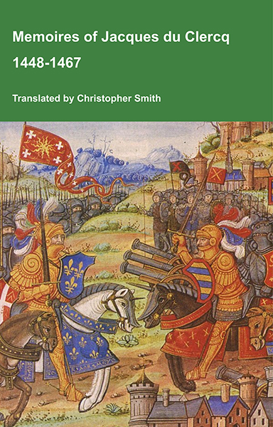
This is a translation of the 'Memoires of Jacques du Clercq', published in 1823 in two volumes, edited by Frederic, Baron de Reissenberg. In his introduction Reissenberg writes: 'Jacques du Clercq tells us that he was born in 1424, and that he was a licentiate in law and a counsellor to Philip the Good, Duke of Burgundy, in the castellany of Douai, Lille, and Orchies. It appears that he established his residence at Arras. In 1446, he married the daughter of Baldwin de la Lacherie, a gentleman who lived in Lille. We read in the fifth book of his Memoirs that his father, also named Jacques du Clercq, had married a lady of the Le Camelin family, from Compiègne. His ancestors, always attached to the counts of Flanders, had constantly served them, whether in their councils or in their armies.' The Memoires cover a period of nineteen years beginning in in 1448, ending in in 1467. It appears that the author had intended to extend the Memoirs beyond that date; no doubt illness or death prevented him from carrying out this plan. As Reissenberg writes the 'merit of this work lies in the simplicity of its narrative, in its tone of good faith, and in a certain air of frankness which naturally wins the reader’s confidence.' Du Clercq ranges from events of national and international importance, including events of the Wars of the Roses in England, to simple, everyday local events such as marriages, robberies, murders, trials and deaths, including that of his own father in Book 5; one of his last entries.
Available at Amazon in eBook and Paperback format.
List of Tables is in Stonehenge A Temple Restored To The British Druids By William Stukeley.

Table II. Prospect of the Roman Road & Wansdyke just above Caston May 20 1724. This demonstrates that Wansdyke was made before the Roman Road. [Note. Stukeley would have been stood here [Map] to record this view. Note the gibbet on top of Furze Knoll [Map]. On the left Cherhill aka Oldbury Hill Fort [Map].]

Table III. Prospect of Stonehenge from the East by Vespasians Camp [Map]. [From left to right, being south to north. Yansbury Camp [Yarnbury Castle [Map]?], who location is unknown, Stonehenge, Stonehenge Avenue [Map], Cursus and N Long Barrow.

Table IV. A view a little beyond Woodyates where the Ikening Street crosses part of a Druid's barrow. Jun 9 1724.

Table V. The Front View of Stonehenge.

Table VII. A Peep into the Santum Sanctorum [Map].

Table X. South East Prospect from Stonehenge. [Left to right, north to south, New King Barrows, a barrow named as Kingbarrow but is likely to be Coneybury Hill Barrow [Map], the spire of Salisbury Cathedral [Map]]

Table XI. Schematic of Stonehenge Phase 3 II Sarsens.

Table XII. The Orthography of Stonehenge Phase 3 II Sarsens.

Table XIII. Prospect of Stonehenge from the Southwest.

Table XIV. The orthographical Section of Stonehenge upon the Cross diameter.

Table XV. The orthographic Section of Stonehenge upon the Chief diameter.
This is a translation of the 'Memoires of Jacques du Clercq', published in 1823 in two volumes, edited by Frederic, Baron de Reissenberg. In his introduction Reissenberg writes: 'Jacques du Clercq tells us that he was born in 1424, and that he was a licentiate in law and a counsellor to Philip the Good, Duke of Burgundy, in the castellany of Douai, Lille, and Orchies. It appears that he established his residence at Arras. In 1446, he married the daughter of Baldwin de la Lacherie, a gentleman who lived in Lille. We read in the fifth book of his Memoirs that his father, also named Jacques du Clercq, had married a lady of the Le Camelin family, from Compiègne. His ancestors, always attached to the counts of Flanders, had constantly served them, whether in their councils or in their armies.' The Memoires cover a period of nineteen years beginning in in 1448, ending in in 1467. It appears that the author had intended to extend the Memoirs beyond that date; no doubt illness or death prevented him from carrying out this plan. As Reissenberg writes the 'merit of this work lies in the simplicity of its narrative, in its tone of good faith, and in a certain air of frankness which naturally wins the reader’s confidence.' Du Clercq ranges from events of national and international importance, including events of the Wars of the Roses in England, to simple, everyday local events such as marriages, robberies, murders, trials and deaths, including that of his own father in Book 5; one of his last entries.
Available at Amazon in eBook and Paperback format.

Table XVI. The Section of Stonehenge looking towards the Entrance.

Table XVII. The inward View of Stonehenge Aug 1722 from the north.

Table XVIII. A direct view of the Remains of the adytum of Stonehenge.

Table XIX. Inward View of Stonehenge from the high altar. Aug 1722.

Table XX. An inward view of Stonehenge from behind ye high Altar looking towards the grand entrance. A little oblique. Aug 1722. A. the altar.

Table XXI. An inward view of Stonehenge. AA the altar or Side view of the cell.

Table XXII. An inward view of the Cell [of Stonehenge] obliquely.

Table XXIII. The Area of Stonehenge.
In order to have a just notion of this avenue, it is necessary to go to the neighbouring height of Haradon hill [Map], on the other side the river. The largest barrow there, which I call Hara's and which probably gave name to the hill, is in the line of the avenue; the ford of Radfin lying between, as we see in the last Plate. I stood upon this hill May 11. 1724. during the total eclipse of the sun, of which I gave an account in my Itinerarium. Here is a most noble view of the work and country about Stonehenge. Whoever is upon the spot cannot fail of a great pleasure in it; especially if the fun be low, either after rising or before setting. For by that means the barrows, the only ornaments of these plains, become very visible, the ground beyond them being illuminated by the suns flaunting rays. You fee as far as Clay-hill beyond Warminster 20 miles off. You fee the spot of ground on the hill, whereon stands Vespasians camp [Map], where I conjecture the avenue to Stonehenge began, and where there was a facellum, as we conceive. From hence to that spot a valley leads very commodiously to Radfin [Map], where the original ford was.
This Radfin-farm [Map] seems to retain its Celtic name: meaning a ford or passage for chariots, the old way of carriage here used. Rhedeg currere, rhedegfain curfitare, in Irijh reathaini. Fin in the old Irish, is white. It regards the chalky road which went up from the ford. 'Tis a pretty place, seated in a flexure of the river, which from hence seems to bend its arms both ways, to embrace the beginning of the avenue. The place is very warm, sheltered from all winds, and especially from the north. I am persuaded it was originally a seat of an Archdruid or Druid. See Mr. Poland discoursing of the Druids houses, p. III. The nuns of Ambresbury too had a chapel there. The ford is now quite disused, because of the bridge by the town's end; and the road of it is foreclosed by hedgerows of pastures on both sides the lane, leading northwards from Ambresbury to north Wiltshire. This road lying between Radfin and the beginning of Stonehenge avenue, is sweetly adorned with viorna. We are supposed now to stand on the tumulus of Hara, an old Irish royal name, and possibly the king who was coadjutor in founding Stonehenge, who lived, it's likely, in the eastern part of Wiltshire: for which reason they directed the avenue this way.
This is a translation of the 'Memoires of Jacques du Clercq', published in 1823 in two volumes, edited by Frederic, Baron de Reissenberg. In his introduction Reissenberg writes: 'Jacques du Clercq tells us that he was born in 1424, and that he was a licentiate in law and a counsellor to Philip the Good, Duke of Burgundy, in the castellany of Douai, Lille, and Orchies. It appears that he established his residence at Arras. In 1446, he married the daughter of Baldwin de la Lacherie, a gentleman who lived in Lille. We read in the fifth book of his Memoirs that his father, also named Jacques du Clercq, had married a lady of the Le Camelin family, from Compiègne. His ancestors, always attached to the counts of Flanders, had constantly served them, whether in their councils or in their armies.' The Memoires cover a period of nineteen years beginning in in 1448, ending in in 1467. It appears that the author had intended to extend the Memoirs beyond that date; no doubt illness or death prevented him from carrying out this plan. As Reissenberg writes the 'merit of this work lies in the simplicity of its narrative, in its tone of good faith, and in a certain air of frankness which naturally wins the reader’s confidence.' Du Clercq ranges from events of national and international importance, including events of the Wars of the Roses in England, to simple, everyday local events such as marriages, robberies, murders, trials and deaths, including that of his own father in Book 5; one of his last entries.
Available at Amazon in eBook and Paperback format.

Table XXIX. Prospect of the Cursus & Stonehenge from the North Aug 6. 1723. A. The Entrance of the Avenue [Map]. B. The 7 Barrows. C. The Kings Barrow [Coneybury Hill Barrow [Map]?]. D. Salisbury Steeple [Map]. E. Stonehenge. [The Stonehenge Greater Cursus in the foreground. Appears to have been sketched from highground at Larkhill [Map]]

Table XXX. Prospect of the west end of the Cursus of Stonehenge. A. The eastern meta [Map]. B. the eastern wing of the avenue [Map]. C. Stonehenge.

Table XXXI. A Prospect of the barrows in Lake field called Eleven barrows & lately the prophets barrows. 2d. Sepr. 1723. A. Stonehenge. Barrow opened by L. Pembroke. SS. by Stukeley.
