The History of William Marshal was commissioned by his son shortly after William’s death in 1219 to celebrate the Marshal’s remarkable life; it is an authentic, contemporary voice. The manuscript was discovered in 1861 by French historian Paul Meyer. Meyer published the manuscript in its original Anglo-French in 1891 in two books. This book is a line by line translation of the first of Meyer’s books; lines 1-10152. Book 1 of the History begins in 1139 and ends in 1194. It describes the events of the Anarchy, the role of William’s father John, John’s marriages, William’s childhood, his role as a hostage at the siege of Newbury, his injury and imprisonment in Poitou where he met Eleanor of Aquitaine and his life as a knight errant. It continues with the accusation against him of an improper relationship with Margaret, wife of Henry the Young King, his exile, and return, the death of Henry the Young King, the rebellion of Richard, the future King Richard I, war with France, the death of King Henry II, and the capture of King Richard, and the rebellion of John, the future King John. It ends with the release of King Richard and the death of John Marshal.
Available at Amazon in eBook and Paperback format.
Avebury Henge is in Avebury Henge and Stones [Map], Avebury Late Neolithic Early Bronze Age, South England Henges.

Avebury Henge is sub-circular ie not a circle. Neither is it symmetrical. Difficult to give the shape a name since it is so irregular.
Carbon Date. 2640BC. Late Neolithic Carbon Dates
Report: Bone, AML 831778, id as animal, from old land surface under bank of henge (NW quadrant, cutting II) at Avebury, Wiltshire, England. Subm M Pitts 1985. [Ed: NGR not given, estimated only.]
ID: 8807, C14 ID: HAR-10325 Date BP: 4640 +/- 70, Start Date BP: 4570, End BP: 4710
OS Letter: SU, OS East: 9, OS North: 69
Archaeologist Name: M Pitts 1982
Reference Name: Radiocarbon, 34, 1992, 61-2; Proc Prehist Soc, 58, 1992, 203-12; Archaeologia, 84, 1935, 99-162; Smith I, 'Windmill Hill and Avebury' (Oxford, 1965)
Council for British Archaeology (2012) Archaeological Site Index to Radiocarbon Dates from Great Britain and Ireland [data-set]. York: Archaeology Data Service [distributor] https://doi.org/10.5284/1017767
![]() Become a Member via our Buy Me a Coffee page to read more.
Become a Member via our Buy Me a Coffee page to read more.
Carbon Date. 2160BC. Early Bronze Age Carbon Dates
Report: Antler, AML 831779, id as red deer, from above bank of henge (NW quadrant) above possible revetment trench at Avebury, Wiltshire, England. Subm M Pitts 1987. Comment (subm): dates possible extension to bank, compatible with HAR-10502. [Ed: NGR not given, estimated only.]
ID: 8808, C14 ID: HAR-10326 Date BP: 4160 +/- 90, Start Date BP: 4070, End BP: 4250
OS Letter: SU, OS East: 9, OS North: 69
Archaeologist Name: A Keiller (age 47) 1937
Reference Name: Radiocarbon, 34, 1992, 61-2; Proc Prehist Soc, 58, 1992, 203-12; Archaeologia, 84, 1935, 99-162; Smith I, 'Windmill Hill and Avebury' (Oxford, 1965)
Council for British Archaeology (2012) Archaeological Site Index to Radiocarbon Dates from Great Britain and Ireland [data-set]. York: Archaeology Data Service [distributor] https://doi.org/10.5284/1017767
![]() Become a Member via our Buy Me a Coffee page to read more.
Become a Member via our Buy Me a Coffee page to read more.
Silbury Hill [Map] is visible from some, but not all, of the Avebury Henge - the red line on the Schematic.

The light orange is land above 150m. The dark orange is land above 200m.
Carbon Date. 2640BC. Late Neolithic Carbon Dates
Report: animal bone; from the old land surface under the henge bank; north-west sector, trench 2, LZ. Excavated in 1982 (Evans et al 1985).
ID: 15117, C14 ID: HAR 10325 Date BP: 4640 +/- 70, Start Date BP: 4710, End BP: 4570
Abstract: Avebury; 1984-85
Reference Name: Bayliss, A, Hedges, R, Otlet, R, Switsur, R, and Walker, J 2012 'Radiocarbon dates: from samples funded by English Heritage between 1981 and 1988', Swindon: English Heritage
Council for British Archaeology (2012) Archaeological Site Index to Radiocarbon Dates from Great Britain and Ireland [data-set]. York: Archaeology Data Service [distributor] https://doi.org/10.5284/1017767
Carbon Date. 2380BC. Early Bronze Age Carbon Dates
Report: Charcoal, AML 822624, from old land surface under henge bank (SE quadrant Cutting X) at Avebury, Wiltshire, England. Subm M Pitts 1987. [Ed: NGR not given, estimated only.]
ID: 8805, C14 ID: HAR-10063 Date BP: 4380 +/- 80, Start Date BP: 4300, End BP: 4460
OS Letter: SU, OS East: 9, OS North: 69
Archaeologist Name: H St George Gray 1914
Reference Name: Radiocarbon, 34, 1992, 61-2; Proc Prehist Soc, 58, 1992, 203-12; Archaeologia, 84, 1935, 99-162; Smith I, 'Windmill Hill and Avebury' (Oxford, 1965)
Council for British Archaeology (2012) Archaeological Site Index to Radiocarbon Dates from Great Britain and Ireland [data-set]. York: Archaeology Data Service [distributor] https://doi.org/10.5284/1017767
![]() Become a Member via our Buy Me a Coffee page to read more.
Become a Member via our Buy Me a Coffee page to read more.
Carbon Date. 2380BC. Early Bronze Age Carbon Dates
Report: charcoal; from the old land surface under the henge bank; south-east sector, cutting X. Excavated by Gray in 1914 (Gray 1935).
ID: 15115, C14 ID: HAR 10063 Date BP: 4380 +/- 80, Start Date BP: 4460, End BP: 4300
Abstract: Avebury; 1984-85
Reference Name: Bayliss, A, Hedges, R, Otlet, R, Switsur, R, and Walker, J 2012 'Radiocarbon dates: from samples funded by English Heritage between 1981 and 1988', Swindon: English Heritage
Council for British Archaeology (2012) Archaeological Site Index to Radiocarbon Dates from Great Britain and Ireland [data-set]. York: Archaeology Data Service [distributor] https://doi.org/10.5284/1017767
Carbon Date. 2190BC. Early Bronze Age Carbon Dates
Report: Charcoal, AML 831777, AV2, id as Crataegus sp, Aesculus sp and Corylus, from old land surface under henge bank at Avebury, Wiltshire, England. Subm M Pitts 1985. [Ed: NGR not given, estimated only.]
ID: 8812, C14 ID: HAR-10500 Date BP: 4190 +/- 90, Start Date BP: 4100, End BP: 4280
OS Letter: SU, OS East: 9, OS North: 69
Archaeologist Name: A Keiller (age 48) 1938
Reference Name: Radiocarbon, 34, 1992, 61-2; Proc Prehist Soc, 58, 1992, 203-12; Archaeologia, 84, 1935, 99-162; Smith I, 'Windmill Hill and Avebury' (Oxford, 1965)
Council for British Archaeology (2012) Archaeological Site Index to Radiocarbon Dates from Great Britain and Ireland [data-set]. York: Archaeology Data Service [distributor] https://doi.org/10.5284/1017767
![]() Become a Member via our Buy Me a Coffee page to read more.
Become a Member via our Buy Me a Coffee page to read more.
Carbon Date. 2190BC. Early Bronze Age Carbon Dates
Report: charcoal; from the old land surface under the henge bank; south-west sector behind stone 14 (excavated by Keiller in 1938 (Smith 1965)).
ID: 15120, C14 ID: HAR 10500 Date BP: 4190 +/- 90, Start Date BP: 4280, End BP: 4100
Abstract: Avebury; 1985-86
Reference Name: Bayliss, A, Hedges, R, Otlet, R, Switsur, R, and Walker, J 2012 'Radiocarbon dates: from samples funded by English Heritage between 1981 and 1988', Swindon: English Heritage
Council for British Archaeology (2012) Archaeological Site Index to Radiocarbon Dates from Great Britain and Ireland [data-set]. York: Archaeology Data Service [distributor] https://doi.org/10.5284/1017767
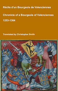
Chronicle of a Bourgeois of Valenciennes
Récits d’un bourgeois de Valenciennes aka The Chronicle of a Bourgeois of Valenciennes is a vivid 14th-century vernacular chronicle written by an anonymous urban chronicler from Valenciennes in the County of Hainaut. It survives in a manuscript that describes local and regional history from about 1253 to 1366, blending chronology, narrative episodes, and eyewitness-style accounts of political, military, and social events in medieval France, Flanders, and the Low Countries. The work begins with a chronological framework of events affecting Valenciennes and its region under rulers such as King Philip VI of France and the shifting allegiances of local nobility. It includes accounts of conflicts, sieges, diplomatic manoeuvres, and the impact of broader struggles like the Hundred Years’ War on urban life in Hainaut. Written from the perspective of a burgher (bourgeois) rather than a monastery or royal court, the chronicle offers a rare lay viewpoint on high politics and warfare, reflecting how merchants, townspeople, and civic institutions experienced the turbulence of the 13th and 14th centuries. Its narrative style combines straightforward reporting of events with moral and civic observations, making it a valuable source for readers interested in medieval urban society, regional politics, and the lived experience of war and governance in pre-modern Europe.
Available at Amazon in eBook and Paperback format.
Carbon Date. 2160BC. Early Bronze Age Carbon Dates
Report: antler; from the bank make-up of the henge, above a supposed revetment trench. Excavated by Keiller in 1937 (Smith 1965).
ID: 15118, C14 ID: HAR 10326 Date BP: 4160 +/- 90, Start Date BP: 4250, End BP: 4070
Abstract: Avebury; 1984-85
Reference Name: Bayliss, A, Hedges, R, Otlet, R, Switsur, R, and Walker, J 2012 'Radiocarbon dates: from samples funded by English Heritage between 1981 and 1988', Swindon: English Heritage
Council for British Archaeology (2012) Archaeological Site Index to Radiocarbon Dates from Great Britain and Ireland [data-set]. York: Archaeology Data Service [distributor] https://doi.org/10.5284/1017767
Carbon Date. 800. Early Medieval
Report: grain; from a pit (1.1m deep, 1.51m x 1.0m across the oval top) containing carbonised grain, probably originally in a basket. This pit was 3m outside the foot of the bank of the Avebury henge monument, on the south-west side, and cut through the first layer of soil rainwashed off the bank, but was covered by a second layer of rainwash, and then by thick topsoil. The estimated date of the bank is between 2500 and 2000 BC.
ID: 15126, C14 ID: HAR 1696 Date BP: 1200 +/- 80, Start Date BP: 1280, End BP: 1120
Abstract: Avebury: School Site; 1976-77
Reference Name: Jordan, D, Haddon-Reece, D, Bayliss, A 1994 'Radiocarbon dates: from samples funded by English Heritage and dated before 1981', London: English Heritage
Council for British Archaeology (2012) Archaeological Site Index to Radiocarbon Dates from Great Britain and Ireland [data-set]. York: Archaeology Data Service [distributor] https://doi.org/10.5284/1017767

Keiller Collection Photos. April 1914. A photo of Avebury's bank and ditch. The figures on the bank are thought to be Harold Gray's (age 42) wife Florence Harriet Young (age 38) and their son Lionel St George Gray (age 13).
Carbon Date. 2300BC. Early Bronze Age Carbon Dates
Report: antler; from the primary fill of the henge ditch, west of the south causeway; gray cutting I. Excavated by Gray in 1909, find no. 136, (Gray 1935).
ID: 15122, C14 ID: HAR 10502 Date BP: 4300 +/- 90, Start Date BP: 4390, End BP: 4210
Abstract: Avebury; 1985-86
Reference Name: Bayliss, A, Hedges, R, Otlet, R, Switsur, R, and Walker, J 2012 'Radiocarbon dates: from samples funded by English Heritage between 1981 and 1988', Swindon: English Heritage
Council for British Archaeology (2012) Archaeological Site Index to Radiocarbon Dates from Great Britain and Ireland [data-set]. York: Archaeology Data Service [distributor] https://doi.org/10.5284/1017767
Carbon Date. 2300BC. Early Bronze Age Carbon Dates
Report: Antler pick, AML 831780, from primary fill of henge ditch W of S entrance (Cutting I) at Avebury, Wiltshire, England. Subm M Pitts 1985. Comment (subm): at face value, slightly earlier than Durrington Walls and Mount Pleasant. [Ed: NGR not given, estimated only.]
ID: 8810, C14 ID: HAR-10502 Date BP: 4300 +/- 90, Start Date BP: 4210, End BP: 4390
OS Letter: SU, OS East: 9, OS North: 69
Archaeologist Name: H St George Gray 1909
Reference Name: Radiocarbon, 34, 1992, 61-2; Proc Prehist Soc, 58, 1992, 203-12; Archaeologia, 84, 1935, 99-162; Smith I, 'Windmill Hill and Avebury' (Oxford, 1965)
Council for British Archaeology (2012) Archaeological Site Index to Radiocarbon Dates from Great Britain and Ireland [data-set]. York: Archaeology Data Service [distributor] https://doi.org/10.5284/1017767
![]() Become a Member via our Buy Me a Coffee page to read more.
Become a Member via our Buy Me a Coffee page to read more.
Carbon Date. 1690BC. Middle Bronze Age Carbon Dates
Report: Charcoal, AML 822623, from deposit of burnt material beneath 'dwarf' burial in secondary fill of ditch (c 2 below modern surface) in terminal of ditch E of S entrance (Cutting IX) at Avebury, Wiltshire, England. Subm M Pitts 1987. [Ed: NGR not given, estimated only.]
ID: 8806, C14 ID: HAR-10064 Date BP: 3690 +/- 80, Start Date BP: 3610, End BP: 3770
OS Letter: SU, OS East: 9, OS North: 69
Archaeologist Name: H St George Gray 1914
Reference Name: Radiocarbon, 34, 1992, 61-2; Proc Prehist Soc, 58, 1992, 203-12; Archaeologia, 84, 1935, 99-162; Smith I, 'Windmill Hill and Avebury' (Oxford, 1965)
Council for British Archaeology (2012) Archaeological Site Index to Radiocarbon Dates from Great Britain and Ireland [data-set]. York: Archaeology Data Service [distributor] https://doi.org/10.5284/1017767
![]() Become a Member via our Buy Me a Coffee page to read more.
Become a Member via our Buy Me a Coffee page to read more.
Carbon Date. 1690BC. Middle Bronze Age Carbon Dates
Report: charcoal; from a deposit of burnt material beneath a 'dwarf' burial in the secondary fill of the henge ditch, 1.8 - 2.1m below the modern surface of the ditch; from the south-east quadrant east of the south entrance. Excavated by Gray in 1914, cutting IX, find no. 247h (Gray 1935).
ID: 15116, C14 ID: HAR 10064 Date BP: 3690 +/- 80, Start Date BP: 3770, End BP: 3610
Abstract: Avebury; 1984-85
Reference Name: Bayliss, A, Hedges, R, Otlet, R, Switsur, R, and Walker, J 2012 'Radiocarbon dates: from samples funded by English Heritage between 1981 and 1988', Swindon: English Heritage
Council for British Archaeology (2012) Archaeological Site Index to Radiocarbon Dates from Great Britain and Ireland [data-set]. York: Archaeology Data Service [distributor] https://doi.org/10.5284/1017767
Avebury Henge Ditch. Avebury 22nd April 1922. "General view of sides, end and bottom of the Fosse (ditch), Cutting IX, looking North West. The levelling rod, 10 foot high. Vertical depth of fosse from upper margin, 30 foot. It is seen that the bottom of the fosse rises considerably from west to east. On the top the two standing stones from the entrance to the great enclosure from the causeway."


From Avebury Henge East Entrance [Map] a path leads east to the Ridgeway Path [Map]; a distance of 2.4 Km.
The Avebury Henge East Entrance [Map] is marked by a stone in the Outer Circle that is considerably larger than other extant stones suggesting the entrance was part of the original design. The entrance opens the track to the Ridgeway Path two kilometres away on Overton Down [Map] on ground ninety metres higher than that on which Avebury is located.
Avebury Henge North Entrance [Map] is marked by a large stone known as the Swindon Stone, which suggests the entrance was part of the original design. The entrance is now used by the A361 road to Swindon which exits at the Avebury Henge South Entrance [Map].
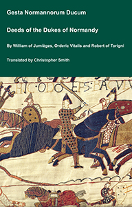
The Deeds of the Dukes of Normandy
The Gesta Normannorum Ducum [The Deeds of the Dukes of Normandy] is a landmark medieval chronicle tracing the rise and fall of the Norman dynasty from its early roots through the pivotal events surrounding the Norman Conquest of England. Originally penned in Latin by the monk William of Jumièges shortly before 1060 and later expanded at the behest of William the Conqueror, the work chronicles the deeds, politics, battles, and leadership of the Norman dukes, especially William’s own claim to the English throne. The narrative combines earlier historical sources with firsthand information and oral testimony to present an authoritative account of Normandy’s transformation from a Viking settlement into one of medieval Europe’s most powerful realms. William’s history emphasizes the legitimacy, military prowess, and governance of the Norman line, framing their expansion, including the conquest of England, as both divinely sanctioned and noble in purpose. Later chroniclers such as Orderic Vitalis and Robert of Torigni continued the history, extending the coverage into the 12th century, providing broader context on ducal rule and its impact. Today this classic work remains a foundational source for understanding Norman identity, medieval statesmanship, and the historical forces that reshaped England and Western Europe between 800AD and 1100AD.
Available at Amazon in eBook and Paperback format.
Antiquity 1939 Volume 13 Pages 223-233. A discovery of considerable importance was made when, on examining material which had been tipped into the ditch to form the course of a medieval track-way, a causeway of solid chalk [Map] was found to exist. An original entrance through the bank and over the ditch from the north was therefore proved to have existed. The breadth of this causeway could not be ascertained owing to its northeastern edge being at present under the main road to Swindon.
The Avebury Henge South Entrance [Map] appears to have been original since it terminates the West Kennet Avenue. Further there are two exceptionally large stones at the entrance that appear to continue the West Kennet Avenue through the entrance to the Avebury South Circle.

Avebury by William Stukeley. Table XII. A piece of the great circle, or A View at the South Entrance [Map] into the temple at Abury Aug. 1722.

Avebury by William Stukeley. Table XVIII. The Entrance of Kennet avenue into Abury [Map] 14 May 1724.
Avebury Henge West Entrance [Map] is somewhat vague with a considerable part of the bank having been removed and the ditch infilled. If it did exist it would have been the start of the Beckhampton Avenue.
Avebury by William Stukeley. When the Lord Stowell [Note. Ralph Stawell 1st Baron Stawell], who owned the manor of Abury, levelled the vallum on that side of the town next the church, where the barn now stands, the workmen came to the original surface of the ground, which was easily discernible by a black stratum of mold upon the chalk. Here they found large quantities of bucks' horns, bones, oyster-shells, and wood coals. The old man who was employed in the work says, there was the quantity of a cart-load of the horns, that they were very rotten, that there were very many burnt bones among them.
The Centre of the Henge [Map] is somewhat difficult to locate given the Henge is sub-circular. Given the alignments of the entrances, and the alignment to the Midwinter Sunset and Midsummer Sunrise, it would appear the centre of the monument is on the corner of the pub car-park where the road from Swindon makes a right turn?
The road through the Henge, inexplicably, makes a curious change in direction twice around the centre? There is no obvious reason why it does this rather than form a straight line between the North and South entrances.
