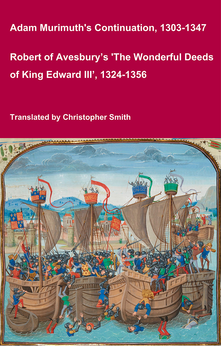
Adam Murimuth's Continuation and Robert of Avesbury’s 'The Wonderful Deeds of King Edward III'
This volume brings together two of the most important contemporary chronicles for the reign of Edward III and the opening phases of the Hundred Years’ War. Written in Latin by English clerical observers, these texts provide a vivid and authoritative window into the political, diplomatic, and military history of fourteenth-century England and its continental ambitions. Adam Murimuth Continuatio's Chronicarum continues an earlier chronicle into the mid-fourteenth century, offering concise but valuable notices on royal policy, foreign relations, and ecclesiastical affairs. Its annalistic structure makes it especially useful for establishing chronology and tracing the development of events year by year. Complementing it, Robert of Avesbury’s De gestis mirabilibus regis Edwardi tertii is a rich documentary chronicle preserving letters, treaties, and official records alongside narrative passages. It is an indispensable source for understanding Edward III’s claim to the French crown, the conduct of war, and the mechanisms of medieval diplomacy. Together, these works offer scholars, students, and enthusiasts a reliable and unembellished account of a transformative period in English and European history. Essential for anyone interested in medieval chronicles, the Hundred Years’ War, or the reign of Edward III.
Available at Amazon in eBook and Paperback format.
Belas Knapp Long Barrow is in Winchcombe, Gloucestershire, Cotswolds Neolithic Tombs.
3000BC. Belas Knapp Long Barrow [Map] is a Severn-Cotswolds Tomb. It has false entrance and four burial chambers.

Annals of Winchcombe and Sudeley Chapter 1. Belas Knap [Map] barrow was opened in 1863. It presented all the interesting features of the long tumuli of the Britons; the cromlech to the north, and sepulchral chambers at the east and west; also a single sepulture, in a grave constructed of rough stones, at the south, possibly a later interment. The walls leading to the entrance of the barrow were constructed of stones unhewn and unchiselled; the stones of the entrance also were without any mark of instrument upon them. It seems as if the sacredness of the spot was esteemed to be enhanced by this absence of workmanship with metal, as in Scripture times: "An altar of earth thou shalt make unto me .... and if thou wilt make me an altar of stone, thou shalt not build it of hewn stone: for if thou lift up thy tool upon it, thou hast polluted it." Exod. xx. 24, 25.
Proceedings of the Cotteswold Naturalists' Field Club Volume 6. Belas Knapp [Map], a Long Barrow situated above Honeybee Wood, near Winchcomb, is constructed of quarried stones, and the large covering stones appear to have been procured from an adjoining quarry. It is sixty-three yards long; thirty-two across its northern or higher and wider part, and twenty-three across its southern, lower and narrower part; it is fourteen feet high at the stonework or platform, and gradually falls off to near a level with the ground, on its southern and small end. The three large stones on the western side may have been the covering of graves near the middle of the Tumulus which had been removed on a former occasion.
The neat stone walling of Stonesfield Slate, gracefully curved to form the heart-shaped entrance, with the huge unhewn stones placed at its northern end to form a platform, presented a most imposing appearance. A large jaw-bone; a long square skull; and bones of children, and infants, were found upon, under and near the large flat stone, with a bone pin, and a bone implement, with two small holes drilled in its end; and a beautifully cut flint saw, with a knife-edge on the back; boars' jaw-bones, teeth, and tusks; horses ' teeth; a bone of the roebuck; bones of birds; and the upper part of a large radius which has been supposed to belong to a lion or cave bear. Graves were found in the small end, on its eastern side, formed of rough dry walling of quarried stones for the sides and ends, and covered or roofed over with flat rough, unhewn stones; and the entrance to the graves was covered with a large stone, five feet by three, and about a foot thick. The grave contained the bones of several individuals, with large oval heads, and narrow foreheads.

Description of the Chambered Tumuli of Uley and Nympsfield. Belas Knap [Map]. — The interesting tumulus of Belas Knap, in the parish of Charlton Abbots, was examined, and described by Mr. Winterbotham in 1863 and 1864.2 The barrow is of the usual heart-shaped form, and it measures 197 feet in length, 75 feet in width near the centre, and from 12 to 13 feet in height. It lies north and south, and is of the same type as the tumuli at Rodmarton and A veiling, having lateral chambers. About a yard within the outer margin of the barrow is a wall of slaty stone, about 2 feet high, except at the north end where it rises to 7 feet, and gradually curves inward so as to make a passage towards the centre. This terminates about 20 ft. from the outer margin by a massive slab, set vertically between two pillars and, with them, supporting a still larger stone set horizontally, but there was no entrance. At the sides of the barrow are two smaller openings leading to chambers, and there is another at the south end (see Fig. 16).
Note 2. Proc. Soc, Antiquaries, Vol. III., 2nd series, p. 275.
Archæological Handbook of Gloucestershire. Belas Knapp Long Barrow [Map]
This celebrated barrow is situated in the parish of Charlton Abbots, seven miles east of Cheltenham and four from Winchcombe, just above a wood known as "Humble Bee How," or "Humble Bey How." It is 197 feet long, and 75 feet wide near the centre, its greatest height being twelve feet six inches. Its direction is north and south, the highest part of the barrow being at the north end. A wall of dry stone surrounded the barrow about two feet high except at the north end, where it rose to seven feet and curved inwards, so as to form a passage towards the centre. This ended about twenty feet from the outer slopes in a massive slab set vertically between two pillars, and supporting a still larger slab set horizontally. At the sides of the barrow are two smaller openings leading to cells, and another cell or cistern is towards the south end. In 1863 a large flat stone, lying exposed on the surface of the barrow at its southern end, was removed, and proved to be the cover of a cell six feet long and two feet six inches wide. In this were found four human bodies, some bones and tusks of boars, a bone scoop, four pieces of pottery, and a few flints. In the autumn of 1863 five more bodies of children and one young man were found at the north end, under a stone eight feet square and two feet thick. Another chamber was found in 1864 on the east side; it was formed of four large rough stones, enclosing an area about five feet square. In this, twelve skeletons were found, but no pottery or flints. Another cistern was found at the south end covered with three large horizontal stones, and walled all round. Another chamber was found on the west side containing the remains of no less than fourteen bodies. The number of skeletons found altogether numbered thirty-eight, of all ages, from the infant to extreme old age. All the skulls were of the dolicho-cephalic type except one, and this was doubtless a secondary interment.
See "Proceedings Soc. Ant.," 2nd ser., vol. III, p275.
Also "Mem. Anthrop. Soc." vol. I, p474.

Long Barrows of the Cotswolds. Belas Knapp Long Barrow [Map]
Gloucestershire 20 S.W. Parish of Charlton Abbots. 12*.
Latitude 51' 53' 13". Longitude 1"34' 04". Height above O.D., about 980 feet.
Belas Knap is in many respects one of the most instructive (and perfect) chambered Long Barrows in Gloucestershire. In plan it resembles Windmill Tump, Rodmarton (No. 56), but it possesses two features peculiar to itself; it is oriented to a point 23 degrees west of true north, and the main portal, or horned end, is at the northern end of the barrow. It was excavated in 1863, 1864 and 1865. The following account is based upon the published accounts of these excavations, supplemented by a careful examination made by the writer and Mr. D. W. Herdman of the Cheltenham Municipal Museum, on October 14th, 1922.
The barrow consists of the following parts:-
(1) A portal (A) at the north end, where the surrounding wall curves gracefully inwards.
(2) A chamber (D) on the west side, approached from outside.
(3) A similar chamber (C) on the east side.
(4) Remains of a passage (B) with corbelled roofing, on the east side.
(5) A passage (E) running N, and S. at the south end of the barrow.
(6) A circle of stones (F) with remains of burning.

Transactions of the Bristol and Gloucestershire Archaeological Society Volume 51 1929. Belas Knap Long Barrow [Map], Gloucestershire. Report by W. J. Hemp 1929, Vol. 51, 261-272.