Text this colour links to Pages. Text this colour links to Family Trees. Text this colour are links that disabled for Guests.
Place the mouse over images to see a larger image. Click on paintings to see the painter's Biography Page.
Mouse over links for a preview. Move the mouse off the painting or link to close the popup.
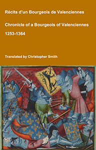
Chronicle of a Bourgeois of Valenciennes
Récits d’un bourgeois de Valenciennes aka The Chronicle of a Bourgeois of Valenciennes is a vivid 14th-century vernacular chronicle written by an anonymous urban chronicler from Valenciennes in the County of Hainaut. It survives in a manuscript that describes local and regional history from about 1253 to 1366, blending chronology, narrative episodes, and eyewitness-style accounts of political, military, and social events in medieval France, Flanders, and the Low Countries. The work begins with a chronological framework of events affecting Valenciennes and its region under rulers such as King Philip VI of France and the shifting allegiances of local nobility. It includes accounts of conflicts, sieges, diplomatic manoeuvres, and the impact of broader struggles like the Hundred Years’ War on urban life in Hainaut. Written from the perspective of a burgher (bourgeois) rather than a monastery or royal court, the chronicle offers a rare lay viewpoint on high politics and warfare, reflecting how merchants, townspeople, and civic institutions experienced the turbulence of the 13th and 14th centuries. Its narrative style combines straightforward reporting of events with moral and civic observations, making it a valuable source for readers interested in medieval urban society, regional politics, and the lived experience of war and governance in pre-modern Europe.
Available at Amazon in eBook and Paperback format.
Ringham Low Chambered Cairn is in Kenslow Farm, Middleton-by-Youlgreave [Map], Peak District Neolithic Burials.
Vestiges of the Antiquities of Derbyshire. September 27th, 1843, a barrow, called Ringham Lowe [Map], on Middleton Moor, was reopened. It was first examined by the late Mr. William Bateman in 1821, who found only the fragments of two urns and a piece of charcoal; one of the urns was of fine black ware, the other very coarse and of a grayish colour. The second investigation did not prove much more interesting than the first; the particulars are as follows: in the centre were the remains of a fire which had burnt upon the surface of the ground, before the construction of the mound; there remained pieces of charred wood, either oak or ash, near three inches in diameter. About the same place some more fragments of the above-mentioned urns were found; also numerous chippings of flint; but no bones, either human or animal, were seen. Near the surface of the tumulus a carefully-chipped instrument of flint was picked up, on refilling the excavation.
Thomas Bateman 1846. On the 17th of the same month a very remarkable tumulus was visited, which is situated upon a piece of ground near the village of Monyash, called Ringham Lowe [Map]. The upper portion being removed, it now presents the appearance of an oval elevation of considerable extent and trifling height, bearing in its present state no slight resemblance to the temple at Arbor Lowe, this idea being strengthened by the immense stones of which the kistvaen is composed.
The oval measures about fifty-four yards by thirty-five, and is thickly studded with vaults of the usual construction, many of which radiate from the central part of the barrow, where one of rather superior size is placed. The latter was cleared out on the above-mentioned day, and was found to consist of four large stones; the one employed to form a side of the cell was ascertained to measure four yards in length, from four to five feet in width, and two feet in thickness; within lay the skeleton of a very old man, upon a flooring of flat stones; with him a small piece of gray flint, apparently a part of a knife, and a cow's tooth. These bones retain much of their natural appearance, being hard and sound, excepting at the ends, which are entirely removed by decay. Two other vaults were opened without success, and in no part of this barrow which could be examined were any traces of calcined bone or pottery apparent.
Near one extremity of this oval tumulus is a small barrow, as at Arbor Lowe; it is much flattened by cultivation, and on opening afforded no relics, its contents being merely a disjointed human skeleton amidst a profusion of rats' bones.
Ten Years' Digging. On the 26th of February [1850], another section was made in the barrow near Kenslow, called Ringham Low [Map], which had been examined twice previously without much success. A few more pieces of Romano-British pottery like that found before, indicated that three urns had been interred in the mound, which consists entirely of earth, and is much like the small barrow at Minning-low, opened 20th July, 1849.

Ten Years' Digging. On the 7th of June, we went to the large chambered tumulus near Monyash, called Ringham Low [Map], some of the cists in which had been examined in 1847 (Vestiges, p. 103), for the purpose of investigating a cist that had been accidentally discovered. It was rather north of the centre of the mound, with the ends east and west (No. 1 of the Plan,) and was rhomboidal in shape, measuring eight feet six inches in length, by four feet in width, the sides were mostly formed by four very large stones, one of which was upwards of nine feet long; the bottom was paved with five slabs of limestone pretty well fitted to each other, the average depth was about eighteen indies. It was filled with limestone gravel, and small stones, covering a large quantity of human remains, most of which were in the utmost disorder, though near the bottom they had been less disturbed, and perhaps, in one or two cases, retained their original position. These have since been ascertained to include the remains of twelve individuals, comprising two infants and ten adults, mostly exhibiting the lengthened form of skull I have before observed to be constantly found in tumuli of the same description as the present.
The lower part of the gravel, and the interstices between the paving-stones, abounded with rats' bones; and on removing part of the floor we found that many human bones had been drawn beneath it by these restless creatures. In clearing out these joints we found three very beautiful leaf-shaped arrow points of white-flint, one of which, considering the material, is of wonderful execution; it measures 2¼ inches in length, is an inch broad in the middle, and weighs less than 48 grains, although it is not made from a thin flake, but is elaborately clipped all over both surfaces. We observed fragments of the skulls of oxen, teeth of horses, dogs, &c, but no trace of pottery, although a little charcoal was mixed with the clay on which the pavement rested.
![]() Become a Member via our Buy Me a Coffee page to read more.
Become a Member via our Buy Me a Coffee page to read more.
Ten Years' Digging. On the 5th of July, we opened another cist on the south side of the wall, which will be seen from the plan to cross the mound at Ringham Low [Map]. This (No. 4 on the Plan) when emptied, exhibited a fine and perfect specimen of primeval architecture, measuring in: Length 9ft, Width at east end 5ft 6in, Ditto at west end 2ft 6in, Depth 4ft. Six stones only were used in its structure, no pavement having been laid down. We left it in the same perfect state as we found it, having discovered only a few human bones, and a roughly chipped block of hard stone, which were embedded without order in a layer of stiff clay, immediately above the natural rock on which, the chamber was based; and a little charcoal at a higher level near the west end.
All the enclosures have been made by large slabs of limestone from the immediate vicinity, set on edge in narrow channels cut in the natural soil to the required shape of the chamber, and then secured in their respective positions by small stones firmly wedged between their sides and the solid earth. The tumulus in which they are distributed is composed of a vast accumulation of stones of all sizes, and is of irregular shape, as will be seen from the plan; its size may be stated as about 50 yards by 30, and its average height 4 feet.

Llewellynn Jewitt 1870. The chambered tumulus, called the "Five Wells [Map]," near Taddington, of which an engraving is here given (fig. 64), has been a mound of large size, and the chambers and passages, or gallery, have been extensive. A plan of this tumulus is given in fig. 65. The "Five Wells [Map]" tumulus consists of two vaults or chambers, situated near the centre of a cairn (which is about thirty yards in diameter), each approached by a separate gallery or avenue, formed by large limestones standing edgeways, extending through the tumulus, respectively in a south-east and north-west direction. These chambers are marked B and G on the plan, G being the cist engraved on fig. 64. E E E are stones supposed to be the capstones thrown down. Another five-chambered tumulus in the same county is called Ringham-Low [Map], which has many interesting remains.


Antiquity 1952 Volume 26 Pages 41-32. Ringham Low [Map]: The Rediscovery of a Derbyshire Chambered Tomb1
Ringham Low (Monyash) was recorded by Bateman in the mid-19th century as a barrow of considerable size and importance2 (Fig. 1). Не shows plans of the barrow and of four of the chambers which it contained. At that time continuous stone-robbing was taking place, so that, when Ward wrote forty years later3, the chambers had all been destroyed. Since then, the location of the site itself has been forgotten and it could not be discovered by Phillips4. Recently, local enquiries revealed, however, that a few fields lying to the east of Ricklow Dale still bear the name Ringham Low. Within these, about 650 yards to the east of Ricklow Dale and 450 yards to the north of Lathkilldale, the o.s. shows a small plantation with tumuli (MR 170/655), which must clearly be Bateman's site. The barrow lies partly beneath this plantation, partly to the north. To the north of the plantation, the barrow has almost completely disappeared, and no signs of chambers remain. Within the walled plantation, the stony ground is covered with undergrowth and any structures are now indefinite. Confusion has probably arisen as Bateman records Ricklow Dale as lying to the east of the barrow; in fact the barrow lies to the east of the dale.
Note 1. This note is published in anticipation of a general paper on the Peak collective tombs, which has been delayed by the authors' absence abroad. It is hoped that other field-workers wil now have an opportunity to give the site the thorough examination which it deserves.
Note 2. T. Bateman, Vestiges, p. 103, and Ten Years Diggings, p. 94, et seq.
Note 3. V.C.H. Derbyshire, Vol. 1, J. Ward, 'Early Man', pp. 165-8.
Note 4. Ordnance Map of the Trent Basin showing distribution of long barrows, megaliths and habitation sites, pp. 10, 17 and 22. It should be noted that the map requires modification as the site is to the east of Monyash.


![]() Become a Member via our Buy Me a Coffee page to read more.
Become a Member via our Buy Me a Coffee page to read more.