William of Worcester's Chronicle of England
William of Worcester, born around 1415, and died around 1482 was secretary to John Fastolf, the renowned soldier of the Hundred Years War, during which time he collected documents, letters, and wrote a record of events. Following their return to England in 1440 William was witness to major events. Twice in his chronicle he uses the first person: 1. when writing about the murder of Thomas, 7th Baron Scales, in 1460, he writes '… and I saw him lying naked in the cemetery near the porch of the church of St. Mary Overie in Southwark …' and 2. describing King Edward IV's entry into London in 1461 he writes '… proclaimed that all the people themselves were to recognize and acknowledge Edward as king. I was present and heard this, and immediately went down with them into the city'. William’s Chronicle is rich in detail. It is the source of much information about the Wars of the Roses, including the term 'Diabolical Marriage' to describe the marriage of Queen Elizabeth Woodville’s brother John’s marriage to Katherine, Dowager Duchess of Norfolk, he aged twenty, she sixty-five or more, and the story about a paper crown being placed in mockery on the severed head of Richard, 3rd Duke of York.
Available at Amazon in eBook and Paperback format.
South Kesteven is in Kesteven.
Around 50AD. Ancaster [Map] was the junction of Ermine Street and King Street. During the Romano-British period, the Romans built a roadside settlement on the site of a
King Street is a Roman Road between Peterborough [Map] and Ancaster [Map] where it joins Ermine Street 2. It is numbered 26 in Ivan Margary's book 'Roman Roads in Britain'.
From Peterborough [Map] it travels north through Lolham Bridges [Map] crossing the River Glen at Kates Bridge [Map], through Bourne where Bourne Abbey, Lincolnshire [Map] was later built. The road continues through Cawthorpe [Map], Stainfield, South Kesteven [Map], Hanby, South Kesteven [Map], Sapperton, South Kesteven [Map] before reaching Ermine Street 2 south of Ancaster [Map].
Ermine Street. From Durobrivae [Map] Ermine Street crosses the River Welland at Stamford [Map] then continues through Great Casterton [Map], Colsterworth [Map], Ancaster [Map]. Continuing on a new alignment Ermine Street passes east of Navenby [Map] meeting the Fosse Way at Bracebridge [Map] with both roads continuing together to Lindum Colonia [Map] aka Lincoln.
In 913 Charles Noel Allix sold Willoughby Hall.
In 1794 Charles Allix [aged 78] died. Reverend Charles Wager Allix [aged 46] inherited Willoughby Hall. John Peter Allix [aged 45] inherited Swaffham Prior House.
In 1795 Reverend Charles Wager Allix [aged 47] died. Colonel Charles Allix [aged 11] inherited Willoughby Hall.
On 9th April 1823 Captain William Kent Allix was born to Colonel Charles Allix [aged 40] and Mary Elizabeth Hammond at Willoughby Hall. He was educated at Harrow School where there is a memorial plaque to him.
On 22nd January 1866 Colonel Charles Allix [aged 83] died. He was buried at St Martin's Church, Ancaster [Map]. Frederick William Allix [aged 49] inherited Willoughby Hall.
On 13th October 1894 Frederick William Allix [aged 78] died. Charles Noel Allix [aged 48] inherited Willoughby Hall.
The River Witham rises near South Witham, South Kesteven [Map] from where it flows past North Witham, South Kesteven [Map], Colsterworth, South Kesteven [Map], Easton, South Kesteven [Map] to Great Ponton, South Kesteven [Map] where it is joined by the Cringle Brook.
From Great Ponton, South Kesteven [Map] the River Witham flows through Grantham [Map], Belton, Grantham [Map], past Barkston, South Kesteven [Map], Marston, South Kesteven [Map] and Hougham, South Kesteven [Map], Westborough, South Kesteven [Map], Long Benington, South Kesteven [Map], Claypole, South Kesteven [Map], Beckingham, North Kesteven [Map], Norton Disney, North Kesteven [Map], Bassingham, North Kesteven [Map], Haddington, North Kesteven [Map], Aubourn, North Kesteven [Map] through the centre of Lincoln, Lincolnshire [Map] where it joined by the River Till.
From Lincoln, Lincolnshire [Map] it flows under Five Mile Bridge [Map], past Bardney Abbey [Map], Kirkstead [Map], under Tattershall Bridge [Map] after which it is joined by the River Bain
After Tattershall the River Witham flows through canalised sections under Lanrick Bridge [Map], past Anton's Gowt [Map] to Boston [Map] where it is joined by the South Forty Foot Drain. After Boston [Map] the River Witham flows into the The Wash around eight kilometres away.
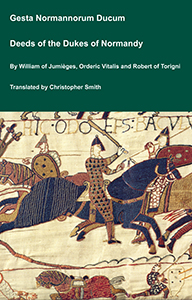
The Deeds of the Dukes of Normandy
The Gesta Normannorum Ducum [The Deeds of the Dukes of Normandy] is a landmark medieval chronicle tracing the rise and fall of the Norman dynasty from its early roots through the pivotal events surrounding the Norman Conquest of England. Originally penned in Latin by the monk William of Jumièges shortly before 1060 and later expanded at the behest of William the Conqueror, the work chronicles the deeds, politics, battles, and leadership of the Norman dukes, especially William’s own claim to the English throne. The narrative combines earlier historical sources with firsthand information and oral testimony to present an authoritative account of Normandy’s transformation from a Viking settlement into one of medieval Europe’s most powerful realms. William’s history emphasizes the legitimacy, military prowess, and governance of the Norman line, framing their expansion, including the conquest of England, as both divinely sanctioned and noble in purpose. Later chroniclers such as Orderic Vitalis and Robert of Torigni continued the history, extending the coverage into the 12th century, providing broader context on ducal rule and its impact. Today this classic work remains a foundational source for understanding Norman identity, medieval statesmanship, and the historical forces that reshaped England and Western Europe between 800AD and 1100AD.
Available at Amazon in eBook and Paperback format.

The South Forty Foot Drain aka Black Sluice is a man-made drain starting at Guthram Gowt [Map] that drains a large area of the Lincolnshire fen-land known as the Black Sluice Area aka Lindsey Level. The drain, or an early version of it was first constructed around 1635 when the Earl of Lindsey agreed with the Commissioners of Sewers for Lincolnshire to carry out drainage works which would make 150 km2 of land available for agricultural use. The South Forty Foot Drain drains the area bounded by Great Hale, North Kesteven [Map], Bourne, South Kesteven [Map], Pinchbeck [Map] and Boston [Map].
Bytham Castle, Lincolnshire is also in Castles in Lincolnshire.

Bytham Castle, Lincolnshire [Map] is (probably) a Norman Castle of Motte and Bailey construction. No stonework remains above ground
Photo by Richard Carter, CC BY-SA 2.0.
On 12th May 1335 Margery de Braose [aged 70] died at Bytham Castle, Lincolnshire [Map].
The River Witham rises near South Witham, South Kesteven [Map] from where it flows past North Witham, South Kesteven [Map], Colsterworth, South Kesteven [Map], Easton, South Kesteven [Map] to Great Ponton, South Kesteven [Map] where it is joined by the Cringle Brook.
From Great Ponton, South Kesteven [Map] the River Witham flows through Grantham [Map], Belton, Grantham [Map], past Barkston, South Kesteven [Map], Marston, South Kesteven [Map] and Hougham, South Kesteven [Map], Westborough, South Kesteven [Map], Long Benington, South Kesteven [Map], Claypole, South Kesteven [Map], Beckingham, North Kesteven [Map], Norton Disney, North Kesteven [Map], Bassingham, North Kesteven [Map], Haddington, North Kesteven [Map], Aubourn, North Kesteven [Map] through the centre of Lincoln, Lincolnshire [Map] where it joined by the River Till.
From Lincoln, Lincolnshire [Map] it flows under Five Mile Bridge [Map], past Bardney Abbey [Map], Kirkstead [Map], under Tattershall Bridge [Map] after which it is joined by the River Bain
After Tattershall the River Witham flows through canalised sections under Lanrick Bridge [Map], past Anton's Gowt [Map] to Boston [Map] where it is joined by the South Forty Foot Drain. After Boston [Map] the River Witham flows into the The Wash around eight kilometres away.
Around 1435 Joan Beaumont Baroness Lovel was born to John Beaumont 1st Viscount Beaumont [aged 25] and Katherine Neville Duchess Norfolk [aged 35] at Edenham, South Kesteven. She a great x 2 granddaughter of King Edward III of England. She married (1) before 1456 her second cousin once removed John Lovell 8th Baron Lovel 5th Baron Holand, son of William Lovell 7th Baron Lovel 4th Baron Holand and Alice Deincourt 6th Baroness Deincourt and Grey, Baroness Lovel and Sudeley, and had issue (2) after 28th February 1463 her half third cousin once removed William Stanley, son of Thomas Stanley 1st Baron Stanley and Jane Goushill Baroness Stanley.
On 22nd July 1779 Robert Bertie 4th Duke Ancaster and Kesteven [deceased] was buried at Edenham, South Kesteven.
The River Witham rises near South Witham, South Kesteven [Map] from where it flows past North Witham, South Kesteven [Map], Colsterworth, South Kesteven [Map], Easton, South Kesteven [Map] to Great Ponton, South Kesteven [Map] where it is joined by the Cringle Brook.
From Great Ponton, South Kesteven [Map] the River Witham flows through Grantham [Map], Belton, Grantham [Map], past Barkston, South Kesteven [Map], Marston, South Kesteven [Map] and Hougham, South Kesteven [Map], Westborough, South Kesteven [Map], Long Benington, South Kesteven [Map], Claypole, South Kesteven [Map], Beckingham, North Kesteven [Map], Norton Disney, North Kesteven [Map], Bassingham, North Kesteven [Map], Haddington, North Kesteven [Map], Aubourn, North Kesteven [Map] through the centre of Lincoln, Lincolnshire [Map] where it joined by the River Till.
From Lincoln, Lincolnshire [Map] it flows under Five Mile Bridge [Map], past Bardney Abbey [Map], Kirkstead [Map], under Tattershall Bridge [Map] after which it is joined by the River Bain
After Tattershall the River Witham flows through canalised sections under Lanrick Bridge [Map], past Anton's Gowt [Map] to Boston [Map] where it is joined by the South Forty Foot Drain. After Boston [Map] the River Witham flows into the The Wash around eight kilometres away.
The Cringle Brook near Buckminster, Leicestershire [Map] from where it flows past Skillington, South Kesteven [Map] and Stoke Rochford [Map] before joining the River Witham at Great Ponton, South Kesteven [Map].
King Street is a Roman Road between Peterborough [Map] and Ancaster [Map] where it joins Ermine Street 2. It is numbered 26 in Ivan Margary's book 'Roman Roads in Britain'.
From Peterborough [Map] it travels north through Lolham Bridges [Map] crossing the River Glen at Kates Bridge [Map], through Bourne where Bourne Abbey, Lincolnshire [Map] was later built. The road continues through Cawthorpe [Map], Stainfield, South Kesteven [Map], Hanby, South Kesteven [Map], Sapperton, South Kesteven [Map] before reaching Ermine Street 2 south of Ancaster [Map].
Honington, South Kesteven.
Our church is open for visitors and individual prayer from 9 am to 4 pm each day
Monument to Sir William Hussey, d.1691.
"In Memory Of Sarah Hussey Wife Of Robert Ap Reece, Of Washingley, In The County Of Huntingdon, Esqre. She Was The Daughter And Heir Of Sir Thomas Hussey Of Huntingdon, Bart. Descended From The 2nd Brother Of The Right Honble. John, Lord Hussey, Baron Of Sleeford, And Lord Lieutenant Of The County Of Lincoln. This Family Did Derive Their Descent From The Ancient Barons Hoese, Or Huse: Temp. Hen. Iii. And Edw. I. Ii. & Iii. She Died The 23d Of April, 1749."
Portrait bust of Sir Thomas Hussey bart., d.1698.
"On the north wall, monuments to Sir William Hussey, d.1691 and Dame Sarah Hussey d.1697 with broken pediment, scrolly cartouches and cherubs"
"Monuments:- those in the north aisle are a notable collection; on the east wall is a marble plaque to Sir Thomas Hussey bart., d.1698 with a gadrooned base supporting a portrait bust and surmounted by a scrolly cartouche bearing a shield of arms. On the north wall, monuments to Sir William Hussey, d.1691 and Dame Sarah Hussey d.1697 with broken pediment, scrolly cartouches and cherubs. Also an altar tomb in the north east angle of the chapel to Thomas Hussey, son of Sir Thomas, d.1676 aged 15 years, black marble ledger slab above limestone tomb chest"
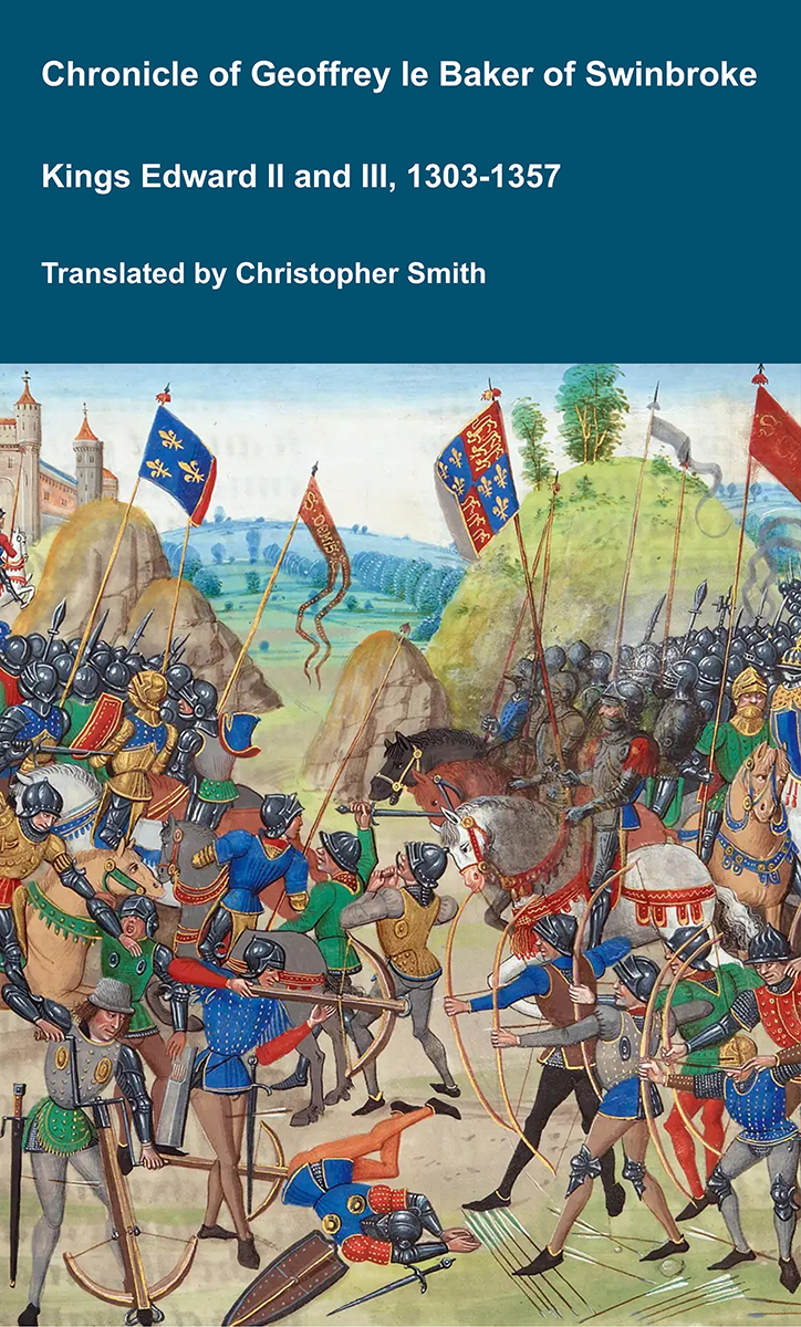
Chronicle of Geoffrey le Baker of Swinbroke
Baker was a secular clerk from Swinbroke, now Swinbrook, an Oxfordshire village two miles east of Burford. His Chronicle describes the events of the period 1303-1356: Gaveston, Bannockburn, Boroughbridge, the murder of King Edward II, the Scottish Wars, Sluys, Crécy, the Black Death, Winchelsea and Poitiers. To quote Herbert Bruce 'it possesses a vigorous and characteristic style, and its value for particular events between 1303 and 1356 has been recognised by its editor and by subsequent writers'. The book provides remarkable detail about the events it describes. Baker's text has been augmented with hundreds of notes, including extracts from other contemporary chronicles, such as the Annales Londonienses, Annales Paulini, Murimuth, Lanercost, Avesbury, Guisborough and Froissart to enrich the reader's understanding. The translation takes as its source the 'Chronicon Galfridi le Baker de Swynebroke' published in 1889, edited by Edward Maunde Thompson.
Available at Amazon in eBook and Paperback format.
The River Witham rises near South Witham, South Kesteven [Map] from where it flows past North Witham, South Kesteven [Map], Colsterworth, South Kesteven [Map], Easton, South Kesteven [Map] to Great Ponton, South Kesteven [Map] where it is joined by the Cringle Brook.
From Great Ponton, South Kesteven [Map] the River Witham flows through Grantham [Map], Belton, Grantham [Map], past Barkston, South Kesteven [Map], Marston, South Kesteven [Map] and Hougham, South Kesteven [Map], Westborough, South Kesteven [Map], Long Benington, South Kesteven [Map], Claypole, South Kesteven [Map], Beckingham, North Kesteven [Map], Norton Disney, North Kesteven [Map], Bassingham, North Kesteven [Map], Haddington, North Kesteven [Map], Aubourn, North Kesteven [Map] through the centre of Lincoln, Lincolnshire [Map] where it joined by the River Till.
From Lincoln, Lincolnshire [Map] it flows under Five Mile Bridge [Map], past Bardney Abbey [Map], Kirkstead [Map], under Tattershall Bridge [Map] after which it is joined by the River Bain
After Tattershall the River Witham flows through canalised sections under Lanrick Bridge [Map], past Anton's Gowt [Map] to Boston [Map] where it is joined by the South Forty Foot Drain. After Boston [Map] the River Witham flows into the The Wash around eight kilometres away.
St Mary's Church, Marston, South Kesteven is also in Churches in Lincolnshire.
St Mary's Church, Marston, South Kesteven [Map]. Open every day. Churchwarden Mrs Barbara Barrodale telephone: 01522 826381
In south chapel, a large dresser tomb of pink and white marble with alabaster recumbent figure flanked by corinthian columns, of Sir Anthony Thorold, died June 1594. Backing onto it at east end of south aisle, another dresser tomb of stone and marble with 3 shields in medillions below and quatrefoil frieze above, of William Thorold, died 1569. Alabaster monument on south wall to Anne, Lady Hodgson (nee Thorold), died 1719, with ornate crown and apron, flanking corinthianesque pilasters and draperies.
On 26th June 1594 Anthony Thorold [aged 74] died. He was buried at St Mary's Church, Marston, South Kesteven [Map].
St Andrew's Church Rippingdale, South Kesteven is also in Churches in Lincolnshire.
St Andrew's Church Rippingdale, South Kesteven [Map]. Contains several medieval effigies in various states of preservation. The guy holding the book is most unusual.
King Street is a Roman Road between Peterborough [Map] and Ancaster [Map] where it joins Ermine Street 2. It is numbered 26 in Ivan Margary's book 'Roman Roads in Britain'.
From Peterborough [Map] it travels north through Lolham Bridges [Map] crossing the River Glen at Kates Bridge [Map], through Bourne where Bourne Abbey, Lincolnshire [Map] was later built. The road continues through Cawthorpe [Map], Stainfield, South Kesteven [Map], Hanby, South Kesteven [Map], Sapperton, South Kesteven [Map] before reaching Ermine Street 2 south of Ancaster [Map].
The Cringle Brook near Buckminster, Leicestershire [Map] from where it flows past Skillington, South Kesteven [Map] and Stoke Rochford [Map] before joining the River Witham at Great Ponton, South Kesteven [Map].
The River Witham rises near South Witham, South Kesteven [Map] from where it flows past North Witham, South Kesteven [Map], Colsterworth, South Kesteven [Map], Easton, South Kesteven [Map] to Great Ponton, South Kesteven [Map] where it is joined by the Cringle Brook.
From Great Ponton, South Kesteven [Map] the River Witham flows through Grantham [Map], Belton, Grantham [Map], past Barkston, South Kesteven [Map], Marston, South Kesteven [Map] and Hougham, South Kesteven [Map], Westborough, South Kesteven [Map], Long Benington, South Kesteven [Map], Claypole, South Kesteven [Map], Beckingham, North Kesteven [Map], Norton Disney, North Kesteven [Map], Bassingham, North Kesteven [Map], Haddington, North Kesteven [Map], Aubourn, North Kesteven [Map] through the centre of Lincoln, Lincolnshire [Map] where it joined by the River Till.
From Lincoln, Lincolnshire [Map] it flows under Five Mile Bridge [Map], past Bardney Abbey [Map], Kirkstead [Map], under Tattershall Bridge [Map] after which it is joined by the River Bain
After Tattershall the River Witham flows through canalised sections under Lanrick Bridge [Map], past Anton's Gowt [Map] to Boston [Map] where it is joined by the South Forty Foot Drain. After Boston [Map] the River Witham flows into the The Wash around eight kilometres away.
King Street is a Roman Road between Peterborough [Map] and Ancaster [Map] where it joins Ermine Street 2. It is numbered 26 in Ivan Margary's book 'Roman Roads in Britain'.
From Peterborough [Map] it travels north through Lolham Bridges [Map] crossing the River Glen at Kates Bridge [Map], through Bourne where Bourne Abbey, Lincolnshire [Map] was later built. The road continues through Cawthorpe [Map], Stainfield, South Kesteven [Map], Hanby, South Kesteven [Map], Sapperton, South Kesteven [Map] before reaching Ermine Street 2 south of Ancaster [Map].