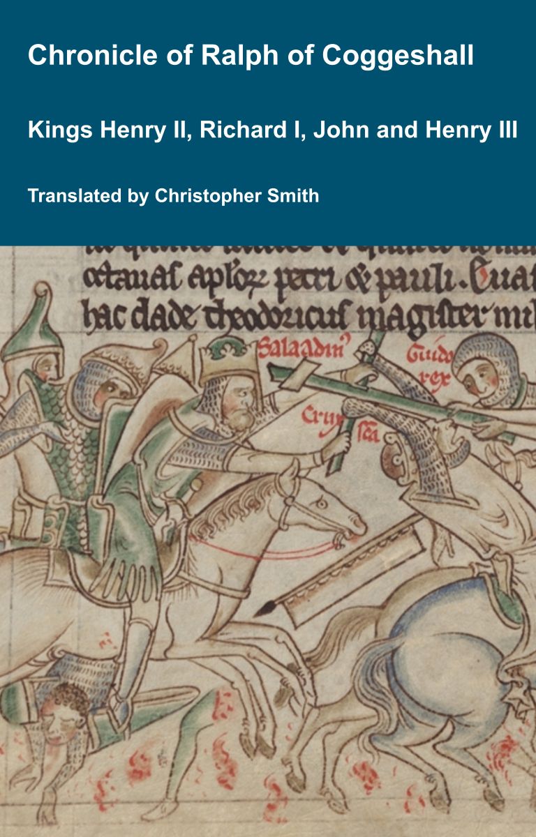
Chronicle of Abbot Ralph of Coggeshall
The Chronicle of Abbot Ralph of Coggeshall (Chronicon Anglicanum) is an indispensable medieval history that brings to life centuries of English and European affairs through the eyes of a learned Cistercian monk. Ralph of Coggeshall, abbot of the Abbey of Coggeshall in Essex in the early 13th century, continued and expanded his community’s chronicle, documenting events from the Norman Conquest of 1066 into the tumultuous reign of King Henry III. Blending eyewitness testimony, careful compilation, and the monastic commitment to record-keeping, this chronicle offers a rare narrative of political intrigue, royal power struggles, and social upheaval in England and beyond. Ralph’s work captures the reigns of pivotal figures such as Richard I and King John, providing invaluable insights into their characters, decisions, and the forces that shaped medieval rule. More than a simple annal, Chronicon Anglicanum conveys the texture of medieval life and governance, making it a rich source for scholars and readers fascinated by English history, monastic authorship, and the shaping of the medieval world.
Available at Amazon in eBook and Paperback format.
Stonehenge Barrows is in Stonehenge Landscape.
Knighton Long Barrow is also in South England Neolithic Burials, Stonehenge Long Barrows.
Knighton Long Barrow [Map]. Historic England 1010052.
A large, impressive Long Barrow orientated east/west. The mound is c.60m long x 20m wide, and is flanked by ditches c.12m wide which are very deep and well defined. The overall width is c.44m.
It is a curious fact that Five Wells Chambered Tomb [Map] is, within 0.2 of a degree of longitude, north of Stonehenge [Map] - see Five Wells Chambered Tomb and Stonehenge Alignment. Moreover, this line of longitude, give or take 500m, has the highest number of Neolithic and Early Bronze Age Monuments on it when compared to other lines of longitude. North to South:
Five Wells Chambered Tomb [Map]
Monkton Fields Long Barrow [Map]
Netheravon 6 Long Barrow [Map]
Knighton Long Barrow [Map]
![]() Become a Member via our Buy Me a Coffee page to read more.
Become a Member via our Buy Me a Coffee page to read more.
Colt Hoare 1812. Iter IV. Starting once more From my head quarters at Amesbury, I shall direct my course towards KNIGHTON LONG BARROW [Map], which, from its elevated situation on a high ridge of land, rivals, if not surpasses, ELL BARROW in preminence of prospect, The first object of our attention: near a clump of trees called ROBIN HOOD BALL [Map], is one those ancient circles, which I have before mentioned and described in the Heytesbury Station, p. 80, This, like the generality of them, is placed on an elevated and commanding situation, but has this peculiarity, of having one circle within the other, with an entrance towards the north. We have to regret the great injury these circles have sustained by the plough, as in their original state they must have been highly curious, and are the more remarkable, from representing a double circle.
Wiltshire Archaeological Magazine 1913 V38 Pages 379-414. Figheldean. 27. "Knighton Barrow [Map],"1 on Knighton Down. Length 182ft.; E. and W. There seems to be no record of this barrow ever having been opened, but it looks as if it had been dug into in more than one place. Although not of great length this is a very fine barrow, and the most conspicuously situated of any in the county, being a landmark for many miles across the Plain in every direction. The mound is of great height and the ditches unusually deep and well defined. It has been much disfigured of late years by the military, who have chosen the southern ditch as a convenient spot in which to put a series of water tanks. O.M. 54 NE.; A. W. I. 175—6.
Note 1. Referred to by Stukeley as "North Long Barrow."
Larkhill Long Barrow is also in South England Neolithic Burials, Stonehenge Long Barrows.
Larkhill Long Barrow [Map]. Historic England 1012167.
The monument includes a Long Barrow situated within Larkhill Camp, north of the Packway. The barrow mound, which is orientated north west - south east, is up to 1.1m high, 46m long and c.16m wide. Flanking the mound on the north east and south west sides are ditches visible as earthworks up to c.7m wide from which material was quarried during construction of the monument.
It is a curious fact that Five Wells Chambered Tomb [Map] is, within 0.2 of a degree of longitude, north of Stonehenge [Map] - see Five Wells Chambered Tomb and Stonehenge Alignment. Moreover, this line of longitude, give or take 500m, has the highest number of Neolithic and Early Bronze Age Monuments on it when compared to other lines of longitude. North to South:
Five Wells Chambered Tomb [Map]
Monkton Fields Long Barrow [Map]
Netheravon 6 Long Barrow [Map]
Larkhill Long Barrow [Map]
![]() Become a Member via our Buy Me a Coffee page to read more.
Become a Member via our Buy Me a Coffee page to read more.
Wiltshire Archaeological Magazine 1913 V38 Pages 379-414. Durrington. 24. [Larkhill Long Barrow [Map]]. On Durrington Down, S.S.W. of Knighton Long Barrow [Map], within a few feet, and N. of, the new military cross-road from Lark Hill to the Devizes —Salisbury Road. Length 142ft.; S.E. and N.W. There is no record of any opening of this barrow. It is planted with trees, and now stands in the middle of a military camping ground, and is in a poor state of preservation. The ditch on the northerly side is still discernible, but that on the other side has been disfigured and obscured by sheds erected by the military. O.M. 54 SW. Not shown by Hoare.
Winterbourne Stoke Crossroads Long Barrow is also in South England Neolithic Burials, Stonehenge Long Barrows.
Winterbourne Stoke Crossroads Long Barrow [Map]. Historic England 1011841.
The monument includes a Long Barrow north east of Winterbourne Stoke crossroads, situated on a south west-north east ridge and having extensive views to the south east across Wilsford Down and Normanton Down. The long barrow is orientated south west-north east along the ridge and forms the origin and focal point of a linear round barrow cemetery which extends some 500m along the ridge to the north east and contains a total of 22 round barrows. The barrow mound is 95m in length, 22m wide, and 2.5m high. It is flanked on the north west and south east by ditches running the length of the mound from which material was quarried during its construction. The north west ditch is 1m deep and c.8m wide. The south east ditch is visible in part, having become largely infilled over the years, but its full width is visible as a vegetation mark on aerial photographs from which it is calculated to be c.10m wide. The long barrow is therefore 95m long and 40m wide. Partial excavation in the 19th century revealed a primary male inhumation with a flint implement, and six secondary inhumations with a plain food vessel 0.75m from the top of the mound.
Winterbourne Stoke Long Barrow is also in South England Neolithic Burials, Stonehenge Long Barrows.
Winterbourne Stoke Long Barrow [Map]. Historic England 1015021.
The monument includes a Long Barrow orientated east - west situated on a downland spur 180m south of the A360 on Winterbourne Stoke Down. The mound is 43m long. A 36m length of the mound survives as a visible earthwork which varies in height from 1.5m high at the western end to c.1m at the eastern end. Beyond this the remainder of the mound is visible as a slight rise in the field surface. The mound is 17m wide and is flanked on either side by a ditch up to 5m wide; that on the south side is visible as a shallow depression. The north western ditch survives as a buried feature. A part excavation by Cunnington in the early 19th century produced a cremation covered with flints and two deep cists containing wood ash and charcoal. The long barrow lies within a levelled field system which has not been included in the scheduling.
Woodhenge Long Barrow is also in South England Neolithic Burials.
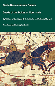
The Deeds of the Dukes of Normandy
The Gesta Normannorum Ducum [The Deeds of the Dukes of Normandy] is a landmark medieval chronicle tracing the rise and fall of the Norman dynasty from its early roots through the pivotal events surrounding the Norman Conquest of England. Originally penned in Latin by the monk William of Jumièges shortly before 1060 and later expanded at the behest of William the Conqueror, the work chronicles the deeds, politics, battles, and leadership of the Norman dukes, especially William’s own claim to the English throne. The narrative combines earlier historical sources with firsthand information and oral testimony to present an authoritative account of Normandy’s transformation from a Viking settlement into one of medieval Europe’s most powerful realms. William’s history emphasizes the legitimacy, military prowess, and governance of the Norman line, framing their expansion, including the conquest of England, as both divinely sanctioned and noble in purpose. Later chroniclers such as Orderic Vitalis and Robert of Torigni continued the history, extending the coverage into the 12th century, providing broader context on ducal rule and its impact. Today this classic work remains a foundational source for understanding Norman identity, medieval statesmanship, and the historical forces that reshaped England and Western Europe between 800AD and 1100AD.
Available at Amazon in eBook and Paperback format.
Woodhenge Long Barrow [Map]. Historic England 1009130.
The monument includes a levelled long barrow aligned north east-south west located some 450m WSW of Woodhenge on Countess Farm and situated on a west facing slope. The barrow is now difficult to identify on the ground. However, the ditches which flank the mound of the long barrow on its western and eastern sides, from which material was quarried during its construction, survive as buried features and are visible as parchmarks. These are represented on a parchmark survey carried out in 1990 from which the overall length of the long barrow can be calculated to be 40m and the overall width 28m.