Text this colour is a link for Members only. Support us by becoming a Member for only £3 a month by joining our 'Buy Me A Coffee page'; Membership gives you access to all content and removes ads.
Text this colour links to Pages. Text this colour links to Family Trees. Place the mouse over images to see a larger image. Click on paintings to see the painter's Biography Page. Mouse over links for a preview. Move the mouse off the painting or link to close the popup.
Northumberland Region is in Northumberland.
The Devil's Causeway is a Roman Road from the Portgate, Northumberland [Map], where it crossed Dere Street, to Berwick on Tweed, Northumberland [Map]. It passes through Great Whittingham, Northumberland [Map], Hartburn, Northumberland [Map], where it crosses the Hart Burn, Netherwitton, Northumberland [Map], Longhorsley, Northumberland [Map], Brinkburn Priory, Northumberland [Map], whereit crosses the River Coquet, north of North End [Map], Edlingham, Northumberland [Map] to Learchild Roman Fort [Map] where another road headed west to meet Dere Street at Bremenium [Map] aka High Rochester. The road then continues north passing Glanton, Northumberland [Map], Powburn, Northumberland [Map], where it crosses the River Till aka Breamish, the site of the Battle of Hedgeley Moor [Map], Newtown, Northumberland [Map], East Horton, Northumberland [Map], Lowick, Northumberland [Map], Berrington, Northumberland [Map] before reaching Berwick on Tweed, Northumberland [Map].
The River Font rises near Ewesley, Northumberland [Map] from where it flows past Nunnykirk, Northumberland [Map], Netherwitton, Northumberland [Map], Newton Underwood, Northumberland [Map] to Mitford, Northumberland [Map] where it joins the River Wansbeck.
East to west Stanegate Roman Road started at Corbridge Roman Fort, Northumberland [Map], then passed through Wall, Northumberland [Map], Fourstones, Northumberland [Map], Newbrough, Northumberland [Map], Vindolandia, Northumberland [Map], Haltwhistle Roman Fort [Map], Magnis aka Carvoran Roman Fort [Map], Nether Denton Roman Fort [Map], Brampton Roman Fort [Map] to Carlisle [Map] where the Roman Fort was located where Carlisle Castle is now. The road may possibly have continued to Kirkbride, Cumberland [Map].
On 28th August 1640 the Battle of Newburn was fought at the Newburn, Northumberland [Map] ford over the River Tyne between the Scottish army of 20,000 men commanded by Alexander Leslie 1st Earl Leven (age 60) and the English army of 5000 commanded by Edward Conway 2nd Viscount Conway (age 46). The Scottish army was successful.
On or before 18th March 1695 George Delaval of North Dissington (age 79) died. He was buried on 18th March 1695 at Newburn, Northumberland [Map].
On 3rd August 1744 Edward Delaval of South Dissington (age 80) died. He was buried at Newburn, Northumberland [Map].
Newminster Abbey, Northumberland is also in Abbeys in England.
Archaeologia Aeliana Series 4 Volume 32 Pages 126-159. 1281. Richard of Gosebek23 was dead in 1281, holding moieties of Bolam, Aydon and South Middleton, and property at Cowpen24. The property was retained in the king's hands, however, as Margery, his widow, was in Suffolk and unable to take the required oath not to marry again without the king's consent25. A few months later she did homage, took the oath, and was given possession26.
At this time we again find a reference to Shortflatt [Map], in a charter granting land in Greenleighton (Lithdon) to Newminster Abbey [Map], one of the boundaries being defined as "the toft of the lady of Shortflatt" (dominae de Scortfiatte)27. The charter is undated, but it immediately follows one of Richard of Gosebek, and it seems probable that the lady of Shortflatt was Margery of Gosebek.
Note 23. For Richard's trans. with the Jews see Cal. Plea Rolls of Exch. of the Jews, II, 252, 314; and I, 217.
Note 24. I.P.M., 1281—Cal. Inq. Edw. I.
Note 25. I.P.M., 1281
Note 26. Cal. C.R., 1281, October 24th.
Note 27. S.S., LXVI, 90, 92.
![]() Become a Member via our 'Buy Me a Coffee' page to read complete text.
Become a Member via our 'Buy Me a Coffee' page to read complete text.
On 14th July 1323 Ralph Greystoke 1st Baron Greystoke (age 23) died at Gateshead, County Durham. Possibly poisoned by a rebel knight. He was buried at Newminster Abbey, Northumberland [Map]. His son William (age 2) succeeded 2nd Baron Greystoke.
In 1325 Robert Umfraville 8th Earl Angus (age 48) died. He was buried at Newminster Abbey, Northumberland [Map]. His son Gilbert (age 15) succeeded 9th Earl Angus.
On 16th July 1350 Joan Willoughby Countess Angus died. She was buried at Newminster Abbey, Northumberland [Map].
All About History Books
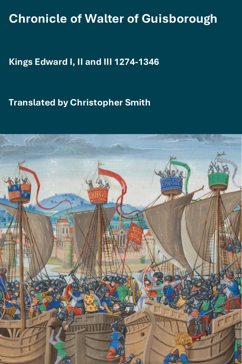
The Chronicle of Walter of Guisborough, a canon regular of the Augustinian Guisborough Priory, Yorkshire, formerly known as The Chronicle of Walter of Hemingburgh, describes the period from 1066 to 1346. Before 1274 the Chronicle is based on other works. Thereafter, the Chronicle is original, and a remarkable source for the events of the time. This book provides a translation of the Chronicle from that date. The Latin source for our translation is the 1849 work edited by Hans Claude Hamilton. Hamilton, in his preface, says: "In the present work we behold perhaps one of the finest samples of our early chronicles, both as regards the value of the events recorded, and the correctness with which they are detailed; Nor will the pleasing style of composition be lightly passed over by those capable of seeing reflected from it the tokens of a vigorous and cultivated mind, and a favourable specimen of the learning and taste of the age in which it was framed." Available at Amazon in eBook and Paperback.
On 6th April 1418 Ralph Greystoke 3rd Baron Greystoke (age 64) died. He was buried at Newminster Abbey, Northumberland [Map]. His son John (age 29) succeeded 4th Baron Greystoke.
In 1437 Robert Umfraville (age 74) died. He was buried at Newminster Abbey, Northumberland [Map].
Collectanea by John Leland [1502-1552]. The XXVIth Day of the said Monneth [26th July 1503] the said Qwene departed from the said Place, after the Custome precedent, varey richly and in fayr Aray. And the sayd Mayr conveyd hyr out of the said Towne, and after tuke Lyve of hyr.
Haff a Mylle owt of the said Towne was Syr Hnmfrey Lyde and the Prior of Bryngburn, well apoynted and well horst, to the Nombre of XX Horsys. Their Folks arayd of their Liveray. And a Mylle from the said Towne was in Ordre the Scheryrfe of Northumberlaund, Syr Rawff Evers, in Company of many other Gentylmen, varey well appoynted, their Folks clothed in their Liveray, well monted. And with them wer many honests Folks of the Countre. with Spers and Bowes, in Jackets, to the Nombre of Two hondreth Horsys.
With the sam fayr Company was the said Qwene conveyd to Morpath [Map], and by the Towne passed in fayr Ordre, wher ther was much People; and so she went to the Abbay [Map], where sche was well receyved by th Abbot and Religyous revested, at the Gatt of the Church, with the Crosse. And after the Receyvyng she was conveyd to her Lodgyngs in the said Place for that sam Nyght.
William Greystoke died at Dunbar Castle, Dunbar. He was buried at Dunbar Castle [Map] then reburied at Newminster Abbey, Northumberland [Map].
In 1249 Constance Gille was born to Thomas Gille at Newsham on Tyne, Northumberland [Map].
The River Font rises near Ewesley, Northumberland [Map] from where it flows past Nunnykirk, Northumberland [Map], Netherwitton, Northumberland [Map], Newton Underwood, Northumberland [Map] to Mitford, Northumberland [Map] where it joins the River Wansbeck.
The Devil's Causeway is a Roman Road from the Portgate, Northumberland [Map], where it crossed Dere Street, to Berwick on Tweed, Northumberland [Map]. It passes through Great Whittingham, Northumberland [Map], Hartburn, Northumberland [Map], where it crosses the Hart Burn, Netherwitton, Northumberland [Map], Longhorsley, Northumberland [Map], Brinkburn Priory, Northumberland [Map], whereit crosses the River Coquet, north of North End [Map], Edlingham, Northumberland [Map] to Learchild Roman Fort [Map] where another road headed west to meet Dere Street at Bremenium [Map] aka High Rochester. The road then continues north passing Glanton, Northumberland [Map], Powburn, Northumberland [Map], where it crosses the River Till aka Breamish, the site of the Battle of Hedgeley Moor [Map], Newtown, Northumberland [Map], East Horton, Northumberland [Map], Lowick, Northumberland [Map], Berrington, Northumberland [Map] before reaching Berwick on Tweed, Northumberland [Map].
The River West Allen rises near Coldcleugh, Northumberland [Map] from where it flows past Carrshield, Northumberland [Map], Ninebanks, Northumberland [Map], Bearsbridge, Northumberland [Map] to just before Cupola Bridge, Northumberland [Map] where it converges with the River East Allen to form the River Allen.
The River Font rises near Ewesley, Northumberland [Map] from where it flows past Nunnykirk, Northumberland [Map], Netherwitton, Northumberland [Map], Newton Underwood, Northumberland [Map] to Mitford, Northumberland [Map] where it joins the River Wansbeck.
The River North Tyne flows from Kielder Water, Northumberland [Map] past Greystead, Northumberland [Map], Bellingham [Map] to Redesmouth, Northumberland [Map] where it is joined by the River Rede.
It continues past Wark, Northumberland [Map], Nunwick, Northumberland [Map], Barrasford, Northumberland [Map], Chollerton, Northumberland [Map], Wall, Northumberland [Map] to Warden, Northumberland [Map] where it joins the River South Tyne to become the River Tyne.
The River Tyne is formed from the River North Tyne and River South Tyne which converge at Warden, Northumberland [Map]. From Warden, Northumberland [Map] it flows past Hexham, Northumberland [Map], Corbridge, Northumberland [Map], Riding Mill, Northumberland [Map], Bywell, Northumberland [Map], Ovingham, Northumberland [Map], Clara Vale, Northumberland [Map], Blaydon, Northumberland [Map], Newcastle upon Tyne, Northumberland [Map] and Wallsend [Map] and North Shields, Northumberland [Map] and South Shields, County Durham [Map] after which it joins the North Sea at Tynemouth, Northumberland [Map].
All About History Books
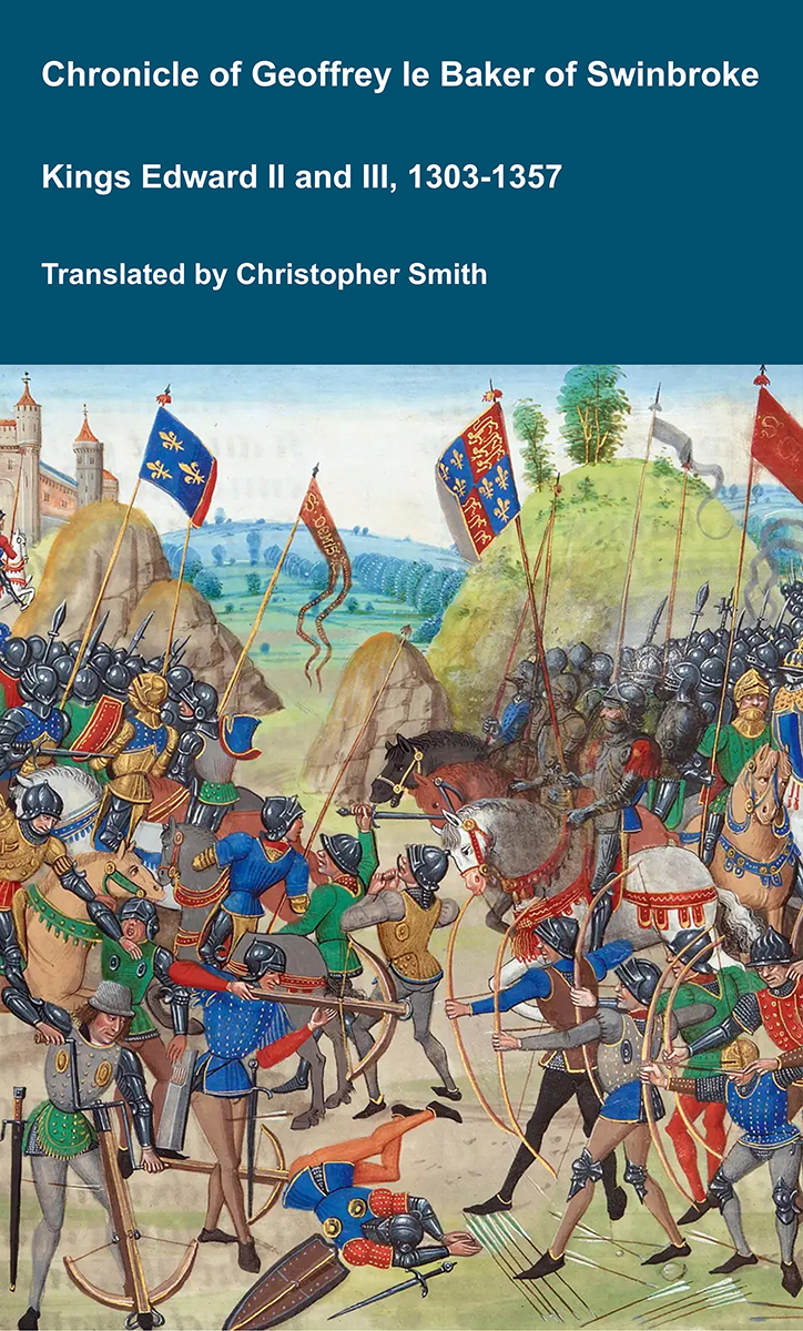
The Chronicle of Geoffrey le Baker of Swinbroke. Baker was a secular clerk from Swinbroke, now Swinbrook, an Oxfordshire village two miles east of Burford. His Chronicle describes the events of the period 1303-1356: Gaveston, Bannockburn, Boroughbridge, the murder of King Edward II, the Scottish Wars, Sluys, Crécy, the Black Death, Winchelsea and Poitiers. To quote Herbert Bruce 'it possesses a vigorous and characteristic style, and its value for particular events between 1303 and 1356 has been recognised by its editor and by subsequent writers'. The book provides remarkable detail about the events it describes. Baker's text has been augmented with hundreds of notes, including extracts from other contemporary chronicles, such as the Annales Londonienses, Annales Paulini, Murimuth, Lanercost, Avesbury, Guisborough and Froissart to enrich the reader's understanding. The translation takes as its source the 'Chronicon Galfridi le Baker de Swynebroke' published in 1889, edited by Edward Maunde Thompson. Available at Amazon in eBook and Paperback.
The River Irthing rises from a number of becks and burns on Padderburn Moor, Northumberland [Map] from where it flows past Churnsike Lodge, Northumberland [Map], Butterburn, Westmoreland and Lampert, Northumberland [Map] where it is joined by the Butter Burn, Smith Farm, Northumberland [Map], Gilsland Spa, Northumberland [Map], Gilsland, Northumberland [Map], Nether Denton, Cumberland [Map], under Lanercost Old Bridge, Cumberland [Map], past Irthington, Cumberland [Map] to Newby East, Cumberland [Map] after which it joins the River Eden.
The River Coquet rises around Chew Green, Northumberland [Map] from where it flows past Makendon Northumberland [Map], Blindburn, Northumberland [Map], Barrow Burn, Northumberland [Map], Shillmoor, Northumberland [Map], Linshiels, Northumberland [Map], Alwinton, Northumberland [Map], Harbottle Castle, Northumberland [Map], Sharperton, Northumberland [Map], Holystone, Northumberland [Map], Hepple, Northumberland [Map], Thropton, Northumberland [Map], Rothbury, Northumberland [Map], Pauperhaugh, Northumberland [Map], Brinkburn Priory, Northumberland [Map], Weldon Bridge, Northumberland [Map], Felton, Northumberland [Map], Guyzance, Northumberland [Map] before passing under the bridge at Warkworth Bridge, Northumberland [Map] and reaching the North Sea at Amble, Northumberland [Map].
The Devil's Causeway is a Roman Road from the Portgate, Northumberland [Map], where it crossed Dere Street, to Berwick on Tweed, Northumberland [Map]. It passes through Great Whittingham, Northumberland [Map], Hartburn, Northumberland [Map], where it crosses the Hart Burn, Netherwitton, Northumberland [Map], Longhorsley, Northumberland [Map], Brinkburn Priory, Northumberland [Map], whereit crosses the River Coquet, north of North End [Map], Edlingham, Northumberland [Map] to Learchild Roman Fort [Map] where another road headed west to meet Dere Street at Bremenium [Map] aka High Rochester. The road then continues north passing Glanton, Northumberland [Map], Powburn, Northumberland [Map], where it crosses the River Till aka Breamish, the site of the Battle of Hedgeley Moor [Map], Newtown, Northumberland [Map], East Horton, Northumberland [Map], Lowick, Northumberland [Map], Berrington, Northumberland [Map] before reaching Berwick on Tweed, Northumberland [Map].
The Devil's Causeway is a Roman Road from the Portgate, Northumberland [Map], where it crossed Dere Street, to Berwick on Tweed, Northumberland [Map]. It passes through Great Whittingham, Northumberland [Map], Hartburn, Northumberland [Map], where it crosses the Hart Burn, Netherwitton, Northumberland [Map], Longhorsley, Northumberland [Map], Brinkburn Priory, Northumberland [Map], whereit crosses the River Coquet, north of North End [Map], Edlingham, Northumberland [Map] to Learchild Roman Fort [Map] where another road headed west to meet Dere Street at Bremenium [Map] aka High Rochester. The road then continues north passing Glanton, Northumberland [Map], Powburn, Northumberland [Map], where it crosses the River Till aka Breamish, the site of the Battle of Hedgeley Moor [Map], Newtown, Northumberland [Map], East Horton, Northumberland [Map], Lowick, Northumberland [Map], Berrington, Northumberland [Map] before reaching Berwick on Tweed, Northumberland [Map].
In 1883 John Mounsey Lambert was born to Major-General George Lambert and Isabella Browne at Breamish House, Powburn [Map]. He was educated at Mister Moore's School at Alnmouth and Wellington College.
On 26th September 1836 Colonel William Robert Craster was born to Thomas Wood aka Craster (age 50) at Preston Tower, Northumberland [Map].
The River Coquet rises around Chew Green, Northumberland [Map] from where it flows past Makendon Northumberland [Map], Blindburn, Northumberland [Map], Barrow Burn, Northumberland [Map], Shillmoor, Northumberland [Map], Linshiels, Northumberland [Map], Alwinton, Northumberland [Map], Harbottle Castle, Northumberland [Map], Sharperton, Northumberland [Map], Holystone, Northumberland [Map], Hepple, Northumberland [Map], Thropton, Northumberland [Map], Rothbury, Northumberland [Map], Pauperhaugh, Northumberland [Map], Brinkburn Priory, Northumberland [Map], Weldon Bridge, Northumberland [Map], Felton, Northumberland [Map], Guyzance, Northumberland [Map] before passing under the bridge at Warkworth Bridge, Northumberland [Map] and reaching the North Sea at Amble, Northumberland [Map].
The River Coquet rises around Chew Green, Northumberland [Map] from where it flows past Makendon Northumberland [Map], Blindburn, Northumberland [Map], Barrow Burn, Northumberland [Map], Shillmoor, Northumberland [Map], Linshiels, Northumberland [Map], Alwinton, Northumberland [Map], Harbottle Castle, Northumberland [Map], Sharperton, Northumberland [Map], Holystone, Northumberland [Map], Hepple, Northumberland [Map], Thropton, Northumberland [Map], Rothbury, Northumberland [Map], Pauperhaugh, Northumberland [Map], Brinkburn Priory, Northumberland [Map], Weldon Bridge, Northumberland [Map], Felton, Northumberland [Map], Guyzance, Northumberland [Map] before passing under the bridge at Warkworth Bridge, Northumberland [Map] and reaching the North Sea at Amble, Northumberland [Map].
The River East Allen rises near Allenheads, Northumberland [Map] from where it flows past Ropehaugh, Northumberland [Map], Spartylea, Northumberland [Map], Sinderhope, Northumberland [Map], Allendale Town, Northumberland [Map], Catton, Northumberland [Map] to just before Cupola Bridge, Northumberland [Map] where it converges with the River West Allen to form the River Allen.
The River Irthing rises from a number of becks and burns on Padderburn Moor, Northumberland [Map] from where it flows past Churnsike Lodge, Northumberland [Map], Butterburn, Westmoreland and Lampert, Northumberland [Map] where it is joined by the Butter Burn, Smith Farm, Northumberland [Map], Gilsland Spa, Northumberland [Map], Gilsland, Northumberland [Map], Nether Denton, Cumberland [Map], under Lanercost Old Bridge, Cumberland [Map], past Irthington, Cumberland [Map] to Newby East, Cumberland [Map] after which it joins the River Eden.
All About History Books
The Chronicle of Geoffrey le Baker of Swinbroke. Baker was a secular clerk from Swinbroke, now Swinbrook, an Oxfordshire village two miles east of Burford. His Chronicle describes the events of the period 1303-1356: Gaveston, Bannockburn, Boroughbridge, the murder of King Edward II, the Scottish Wars, Sluys, Crécy, the Black Death, Winchelsea and Poitiers. To quote Herbert Bruce 'it possesses a vigorous and characteristic style, and its value for particular events between 1303 and 1356 has been recognised by its editor and by subsequent writers'. The book provides remarkable detail about the events it describes. Baker's text has been augmented with hundreds of notes, including extracts from other contemporary chronicles, such as the Annales Londonienses, Annales Paulini, Murimuth, Lanercost, Avesbury, Guisborough and Froissart to enrich the reader's understanding. The translation takes as its source the 'Chronicon Galfridi le Baker de Swynebroke' published in 1889, edited by Edward Maunde Thompson. Available at Amazon in eBook and Paperback.
The River East Allen rises near Allenheads, Northumberland [Map] from where it flows past Ropehaugh, Northumberland [Map], Spartylea, Northumberland [Map], Sinderhope, Northumberland [Map], Allendale Town, Northumberland [Map], Catton, Northumberland [Map] to just before Cupola Bridge, Northumberland [Map] where it converges with the River West Allen to form the River Allen.
The River Wansbeck rises near Risdale, Northumberland [Map] from where it flows past Kirkwhelpington, Northumberland [Map], Wallington, Northumberland [Map], Low Angerton, Northumberland [Map] to Meldon Park, Northumberland [Map] where it is joined by the Hart Burn.
The River Wansbeck continues through Mitford, Northumberland [Map] where it is joined by the River Font.
After Mitford, Northumberland [Map] the River Wansbeck flows past Morpeth, Northumberland [Map], Guidepost, Northumberland [Map] and Stakeford, Northumberland [Map] before joining the North Sea at Cambois, Northumberland [Map].
The River Blyth rises near Kirkheaton, Northumberland [Map] from where it flows past Bradford [Map], Belsay, Northumberland [Map], Ogle, Northumberland [Map], Kirkley, Northumberland [Map], Horton Grange, Northumberland [Map], Stannington, Northumberland [Map], Bedlington, Northumberland [Map] to Blyth, Northumberland [Map] where it reaches the North Sea.
St Mary's Church, Stannington is also in Churches in Northumberland.
St Mary's Church, Stannington [Map]. Sir Mathew White Ridley (1904) by Sir Mathew White Ridley; bronze effigy with marble base by Detmar Blow
The River Coquet rises around Chew Green, Northumberland [Map] from where it flows past Makendon Northumberland [Map], Blindburn, Northumberland [Map], Barrow Burn, Northumberland [Map], Shillmoor, Northumberland [Map], Linshiels, Northumberland [Map], Alwinton, Northumberland [Map], Harbottle Castle, Northumberland [Map], Sharperton, Northumberland [Map], Holystone, Northumberland [Map], Hepple, Northumberland [Map], Thropton, Northumberland [Map], Rothbury, Northumberland [Map], Pauperhaugh, Northumberland [Map], Brinkburn Priory, Northumberland [Map], Weldon Bridge, Northumberland [Map], Felton, Northumberland [Map], Guyzance, Northumberland [Map] before passing under the bridge at Warkworth Bridge, Northumberland [Map] and reaching the North Sea at Amble, Northumberland [Map].
The River Wansbeck rises near Risdale, Northumberland [Map] from where it flows past Kirkwhelpington, Northumberland [Map], Wallington, Northumberland [Map], Low Angerton, Northumberland [Map] to Meldon Park, Northumberland [Map] where it is joined by the Hart Burn.
The River Wansbeck continues through Mitford, Northumberland [Map] where it is joined by the River Font.
After Mitford, Northumberland [Map] the River Wansbeck flows past Morpeth, Northumberland [Map], Guidepost, Northumberland [Map] and Stakeford, Northumberland [Map] before joining the North Sea at Cambois, Northumberland [Map].
The River Tyne is formed from the River North Tyne and River South Tyne which converge at Warden, Northumberland [Map]. From Warden, Northumberland [Map] it flows past Hexham, Northumberland [Map], Corbridge, Northumberland [Map], Riding Mill, Northumberland [Map], Bywell, Northumberland [Map], Ovingham, Northumberland [Map], Clara Vale, Northumberland [Map], Blaydon, Northumberland [Map], Newcastle upon Tyne, Northumberland [Map] and Wallsend [Map] and North Shields, Northumberland [Map] and South Shields, County Durham [Map] after which it joins the North Sea at Tynemouth, Northumberland [Map].
The River North Tyne flows from Kielder Water, Northumberland [Map] past Greystead, Northumberland [Map], Bellingham [Map] to Redesmouth, Northumberland [Map] where it is joined by the River Rede.
It continues past Wark, Northumberland [Map], Nunwick, Northumberland [Map], Barrasford, Northumberland [Map], Chollerton, Northumberland [Map], Wall, Northumberland [Map] to Warden, Northumberland [Map] where it joins the River South Tyne to become the River Tyne.
The River Coquet rises around Chew Green, Northumberland [Map] from where it flows past Makendon Northumberland [Map], Blindburn, Northumberland [Map], Barrow Burn, Northumberland [Map], Shillmoor, Northumberland [Map], Linshiels, Northumberland [Map], Alwinton, Northumberland [Map], Harbottle Castle, Northumberland [Map], Sharperton, Northumberland [Map], Holystone, Northumberland [Map], Hepple, Northumberland [Map], Thropton, Northumberland [Map], Rothbury, Northumberland [Map], Pauperhaugh, Northumberland [Map], Brinkburn Priory, Northumberland [Map], Weldon Bridge, Northumberland [Map], Felton, Northumberland [Map], Guyzance, Northumberland [Map] before passing under the bridge at Warkworth Bridge, Northumberland [Map] and reaching the North Sea at Amble, Northumberland [Map].
On 24th December 1884 Captain Charles Noel Ridley was born to John H Ridley (age 35) at Wellborn, Northumberland.
The River Aln rises near Alnham, Northumberland [Map] from where it flows past Whittingham, Northumberland [Map], Bolton, Northumberland [Map], Hulne Priory, Northumberland [Map] then passing around Alnwick Castle, Northumberland [Map] before passing Lesbury, Northumberland [Map] then at Alnwick, Northumberland [Map] it joins the North Sea.

By February 1537 Robert Collingwood was advising Thomas Howard 3rd Duke of Norfolk (age 64) about lawless elements in Redesdale and Tynedale and later he was involved in the attempt to bridle them. He and John Horsley corresponded with Cromwell on border matters and Norfolk, who twice stayed at his house at Eslington [Map], told Cromwell in July 1537 that he trusted Collingwood above all others in that region.
All About History Books
The Chronicle of Geoffrey le Baker of Swinbroke. Baker was a secular clerk from Swinbroke, now Swinbrook, an Oxfordshire village two miles east of Burford. His Chronicle describes the events of the period 1303-1356: Gaveston, Bannockburn, Boroughbridge, the murder of King Edward II, the Scottish Wars, Sluys, Crécy, the Black Death, Winchelsea and Poitiers. To quote Herbert Bruce 'it possesses a vigorous and characteristic style, and its value for particular events between 1303 and 1356 has been recognised by its editor and by subsequent writers'. The book provides remarkable detail about the events it describes. Baker's text has been augmented with hundreds of notes, including extracts from other contemporary chronicles, such as the Annales Londonienses, Annales Paulini, Murimuth, Lanercost, Avesbury, Guisborough and Froissart to enrich the reader's understanding. The translation takes as its source the 'Chronicon Galfridi le Baker de Swynebroke' published in 1889, edited by Edward Maunde Thompson. Available at Amazon in eBook and Paperback.
In April 1553 Robert Collingwood paid £766 for a grant to himself and his brother Alexander of ex-monastic property in Northumberland. He had laid the basis of his estates in the county in 1542 when he bought Eslington [Map] from Bertram Haselrigge.
Goodenough Fountain, Whittingham [Map]. In memory of Elizabeth Anne, wife of Reverend R W Goodenough. 1874.


Learchild Roman Fort [Map] fort is preserved as a cropmark or very low earthwork. Partial excavation has shown that the remnant ramparts and below ground features such as ditches will contain important archaeological deposits relating to the construction, development, use and abandonment of the monument. The fort contains two constructional phases and therefore provides insight into the development in Roman military fortifications between the 1st and 2nd centuries AD. More widely the monument also provides insight into the Roman conquest of northern England.
The Devil's Causeway is a Roman Road from the Portgate, Northumberland [Map], where it crossed Dere Street, to Berwick on Tweed, Northumberland [Map]. It passes through Great Whittingham, Northumberland [Map], Hartburn, Northumberland [Map], where it crosses the Hart Burn, Netherwitton, Northumberland [Map], Longhorsley, Northumberland [Map], Brinkburn Priory, Northumberland [Map], whereit crosses the River Coquet, north of North End [Map], Edlingham, Northumberland [Map] to Learchild Roman Fort [Map] where another road headed west to meet Dere Street at Bremenium [Map] aka High Rochester. The road then continues north passing Glanton, Northumberland [Map], Powburn, Northumberland [Map], where it crosses the River Till aka Breamish, the site of the Battle of Hedgeley Moor [Map], Newtown, Northumberland [Map], East Horton, Northumberland [Map], Lowick, Northumberland [Map], Berrington, Northumberland [Map] before reaching Berwick on Tweed, Northumberland [Map].
Ravensworth Statue And Fountain, Whittingham [Map]. 1905. Fountain and statue of Atholl Liddell 3rd Earl of Ravensworth commissioned by Caroline Cecelia Edgecumbe Countess Revensworth and Mount Edgecumbe (age 65).
Atholl Liddell 3rd Earl of Ravensworth: On 6th August 1833 he was born to Henry Thomas Liddell 1st Earl Ravensworth and Isabella Horatia Seymour. On 9th October 1866 Atholl Liddell 3rd Earl of Ravensworth and Caroline Cecelia Edgecumbe Countess Revensworth and Mount Edgecumbe were married. He the son of Henry Thomas Liddell 1st Earl Ravensworth and Isabella Horatia Seymour. On 22nd July 1903 Henry Liddell 2nd Earl of Ravensworth died. His brother Atholl succeeded 3rd Earl Ravensworth, 4th Baron Ravensworth of Ravensworth Castle in County Durham, 9th Baronet Liddell of Ravensworth Castle. Caroline Cecelia Edgecumbe Countess Revensworth and Mount Edgecumbe by marriage Countess Ravensworth. On 7th February 1904 Atholl Liddell 3rd Earl of Ravensworth died. Earl Ravensworth extinct. His first cousin Arthur succeeded 5th Baron Ravensworth of Ravensworth Castle in County Durham, 10th Baronet Liddell of Ravensworth Castle. Sophia Harriett Waller Baroness Ravensworth by marriage Baroness Ravensworth of Ravensworth Castle in County Durham.


The Times. 5th February 1929. The funeral of the Earl of Durham (deceased) took place yesterday at Burnmoor. The Countess of Durham (age 69) who was unable to attend owing to illness, received the following telegram from the Queen (age 61):- "I send you and your family my sincere sympathy in your great sorrow.".
The cortege left Fenton [Map] at 11.30, and, as followed by 25 coaches, three of which conveyed wreaths. The chief mourners included Viscount Lambton (age 44) and Captain the Hon. Claud Lambton (age 45) (sons). Captain the Hon. D'Arcy Lambton (age 62), the Hon. George Lambton (age 68), and the Hon. Charles Lambton (age 71) (brothers). Viscount Cecil (brother-in-law), the Earl (age 56) and Countess of Ellesmnere (age 48) (son-in-law and daughter), the Earl of Home (son-in-law). The officiating clergy were the Rev. Ralph Watson. the Rev. A. J. Gadd, the rector, and the Rev. G. F. Eolme. Tenants from Lord Durham's Fenton Estate were the bearers. A memorial eervice for Lord Durham was held vesterday at St. Peter's. Eaton-square, the Rev. Austin Thompson officiating. Among those present were:- The Hon. Mrs. Charles Lambton. the Bon. Mrs. Claud Lambton, Air. D'Arcy [?]. the Earl and Countess of Pembroke. Colonel the Hon. George Herhert also represented the Dowager Countess of Pembroke. Mr Arthur Lambton, the Duke and Duchess of Abereorn the Dowager Marchioness of Lansdowne Alberta Marchioness of Blanford.


